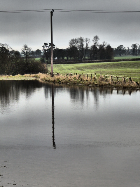
Look. Here was the scene in the field near our house, in January this year. Fields and roads flooded, impassable pathways, rocks and earth tumbling into the River Ure.
Near Old Sleningford, January 2016.
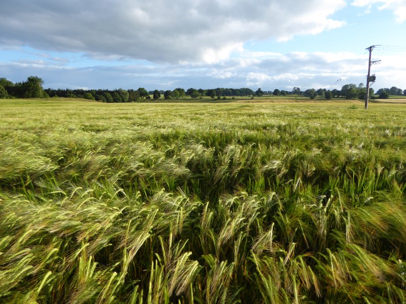
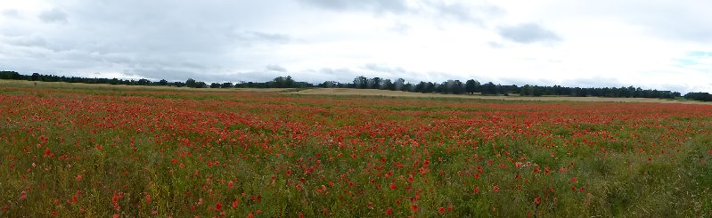
This was the same field yesterday. Barley, barley everywhere, all fattening up nicely for the harvest. Nearby, fields of poppies. Really hopeful, cheery sights on a sunny and blustery day.
The same field, July 2016
Will all our present political crises end so well? I wish I could feel more optimistic.
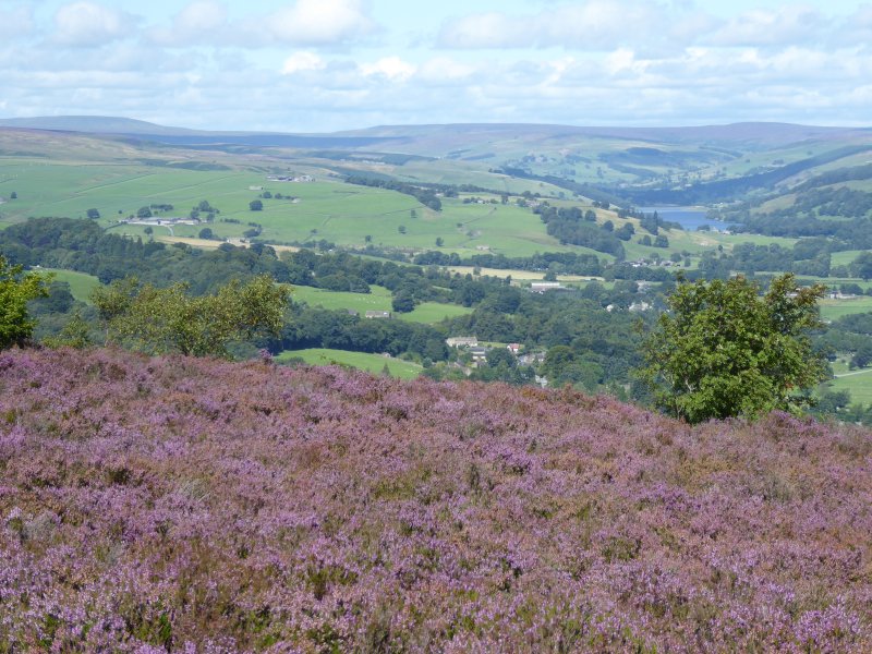
We went for a walk from Leighton Reservoir this week. It’s in many ways a bleak, bare, sometimes boggy landscape, and this suited our mood in a bleak, bare post-Brexit week. The view is softened at the edges by the rolling, green, stone wall-skirted Yorkshire Dales which lie beyond the heathery moors.
But look what we found as we consulted our Ordnance Survey map. These were the places we passed, or could see at a distance:
Sourmire Moor
Gollinglith
Baldcar Head
Jenny Twigg and her daughter Tib (Two natural stone stacks towering out of this boggy moorland landscape. We didn’t get as near to them as we’d have liked this time)
Grewelthorpe Moor
Benjy Guide
Sievey Hill
Horse Helks
Cat Hole
Jenny Twigg and her daughter Tib (Wikimedia Commons)
Really, where else could we be but Yorkshire?
Postscript: Just at the end we met this little chap, a just-fledged thrush. We hope he (she?)’s ok, because he just about managed to fly rather stumblingly off to a safer place than the track where we spotted him.
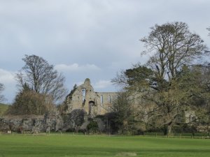
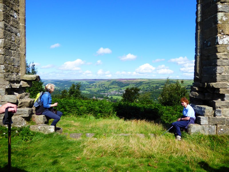
I first walked from Jervaulx to Jervaulx last April, and wrote about it here. However, I failed to lead my fellow ramblers along the same route later that month as I’d said I would, because it rained…. and rained. I’d promised them the walk though, and today was the day: bright, sunny, blustery – a perfect winter hike. Except for one thing. Those floods that have dominated British news this winter are still making their presence felt.
The ruins of Jervaulx.
Our route today didn’t take us through pastureland. Sheep aren’t very good at being knee-deep in mud. It took us through soggy fields, and past lake after lake after lake: waters that simply were not there last time I took this route. It was all very pretty. Less pretty was the scene at stiles. Look at us skidding and sliding, trying to pick the shallower puddles as we waited out turn to get from one field to another.
We’re British though, always plucky in adversity. We soldiered on, sometimes a little weary of heaving mud-crusted boots along sticky, sludgy paths. But nobody fell over, nobody lost their sandwiches in the mud. Everybody enjoyed those vistas over the Dales, the starkly beautiful skeletal outlines of winter trees, the blue skies, dappled with characterful cloud. Were we glad to have made the effort? Well, I was, and I think my steadfast and dependable companions were too.
I’m at university this week. The University of Blogging. This seat of learning, which has no rector, no library and confers no degrees, runs a programme regularly hosted by WordPress,and aims to bring together people who from all over the world, keen to hone their writing and presentation skills, and to help each other to Write a Better Blog.
Today’s assignment:
Publish a post you’d like your ideal audience member to read.
I’ve chosen to write for one of you. We haven’t met. We don’t live on the same continent. But we’re ‘blogging friends’ who enjoy one another’s posts and often say so. You say you like the posts I write about walking in the Yorkshire Dales. I like the posts in which you too describe your walks, often more extensive than mine, taking place over several days. You stride beside me – virtually of course – as I tramp along the leaf mould paths of a dappled English woodland. I stop to gaze across the green and undulating hills at the lattice work of ancient fields, divided by drystone walls, and share the view with you courtesy of my camera.
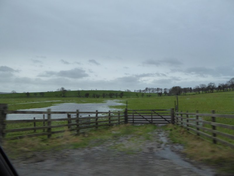
Except… I haven’t. Not lately. Those floods I wrote about a couple of weeks ago are an ever-present danger to some. And even for those who haven’t had flooded homes to contend with, the weekly rhythm has changed. Walking is quite simply not on. The other day, fed up with the lack of exercise, I took myself off to walk along country roads instead. I’d not been going ten minutes when I met a deep trough as wide as the road, as deep as my ankles, and as long as… well, I don’t know. It went beyond the next bend, anyhow, and I went home. The fields are home to seagulls who bob about on the choppy waters. The paths are streams. The streams are rivers. And the rivers are seas.
Quiz question. Which is the path, and which the brook?
A path through the woods.
Brian can’t wait to get home.
i) Quiz question: which is the path, and which the brook?
ii) This, I’m afraid, is a path.
iii) Brian-from-Bolton simply can’t stand getting his paws muddy. He’s urging me home – NOW.
But I’m keen to get out and about again as soon as I can. And I hope you’ll come with me, in a virtual sort of way, when I report back.
I’m not so blinkered as to believe that Yorkshire has all the best bits of scenery. I’ve had days to recharge the soul in every English county from south to north, from west to east, enjoying stirring uplands, gentle verdant hillsides, sky-filled flatlands, slowly-flowing rivers and tranquilly tinkling streams, and the constantly-changing views from the beach at the seaside.
All the same, what we saw whilst out walking today gave every picture postcard of anywhere outside the Yorkshire Dales a run for its money.
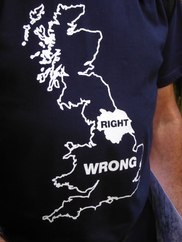
John’s view of Yorkshire, as described on his T-shirt, is the correct one.
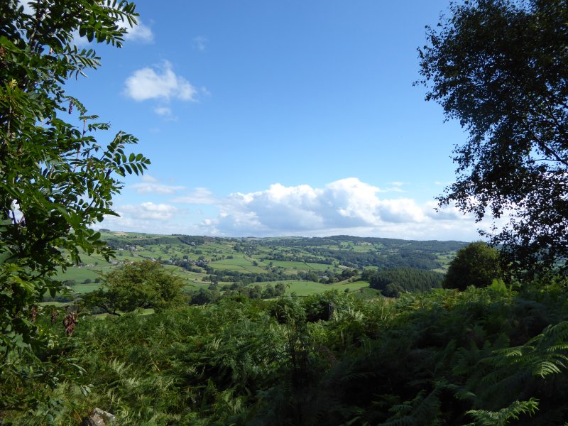
From Pateley Bridge, set in the heart of Nidderdale (Area of Outstanding Natural Beauty), we energetically panted and clambered through Guisecliff Wood, whilst looking down at the village of Glasshouses below. We emerged, puffing for breath at the top, One way, we could look across the Daleside landscape of ancient field systems and stone-built settlements, to the vale of York beyond.
Looking across towards the Dales.
The other way were the moors, no longer bleak, because this is heather time. We breathed in the intoxicating smell that I like to buy potted up as rich, almost peaty flavoured heather honey. We stared, almost mesmerised at those carpets of blooms stretching away from us, mile after mile: not lilac, not lavender, not violet nor damson – simply that special low-key subtle purple that only heather can deliver.
Marching through the heather.
Past Yorke’s Folly: it’s said it was built in 1810, commissioned by the local landowner, John Yorke of Bewerley Hall, who was casting about for some means to keep his labourers in employment in a time of economic depression. These men received a shilling and a loaf of bread a day for their efforts.
Yorke’s Folly: a resting place for weary walkers to enjoy the view.
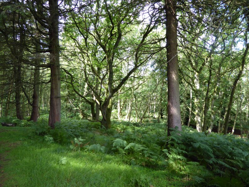
Then it was back to woodland again – very English woodland, with a full green canopy, not yet ready to turn to autumnal colours. Skrikes Wood, Nought Bank, Fishpond Wood.
Skrikes Wood.
Then back along a few final paths before returning to Pateley, and a very welcome pub lunch.
We’ve had quite a weekend. Our vaguely organised daily lives, with plenty of chances to stand and stare, or at least sit down with a cup of coffee and the paper have been shot to pieces by the arrival, for two days only, of our twin nine-year old grandsons, Alex and Ben.
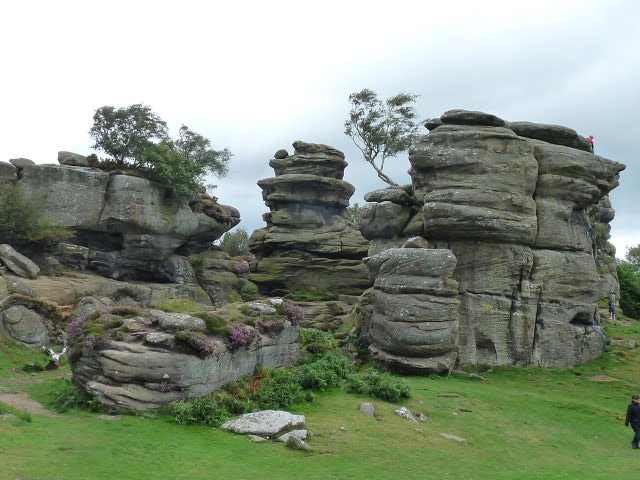
We had a busy Saturday, full of pancakes, playgrounds, and Ripon’s Prison and Police Museum (recommended). But the highlight of the day was Brimham Rocks.
It’s an extraordinary place. There, slap-bang in the middle of the rolling and verdant Yorkshire Dales, is a 30 acre fantastical landscape. Dry-stone walled fields and charming villages are suddenly replaced by an odd collection of weird and wonderful shaped rocks. Brimham Rocks. These are formed from millstone grit: glaciation, wind and rain have eroded them into extraordinary formations, pierced by holes, balancing apparently precariously, or stacked into tottering towers. Geologists study them, rock climbers scramble up them, but above all, families come to let their children become impromptu explorers, mountaineers and adventurers of every kind.
We’ve only chosen quiet times to visit here in the past, but with Alex and Ben, we had no choice, We wanted to take them there, so a brisk and breezy Saturday slap-bang in the middle of the school holidays it was. The car park was overflowing . Oh dear.
But it was fine. The space is big enough to provide room for all. And it was fun to be amongst children from the smallest toddler to the tallest and lankiest of teenagers, all having an equally good time: all exploring, all testing themselves physically, weaving their own adventures.
Alex and Ben take a pause at Brimham Rocks
And besides, we didn’t come home empty-handed. August is bilberry season. Alex and Ben, particularly Ben, rose to the challenge of stripping the small and rather hidden fruits, becoming ever more purple as time passed. Teeth turned blue, hands indelibly stained, fingernails beyond help from any nailbrush: it was so good to see my grandchildren discovering the pleasures of food-for-free. Bilberry pancakes for Sunday breakfast then…..
Malham: a place that sums up Yorkshire scenery and countryside, and a geology lesson in a landscape.
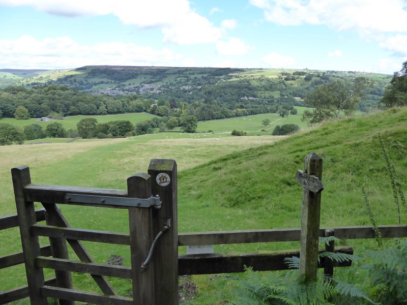
We – the Ripon Ramblers – had come to walk from Malham to the cove which shares its name, then on to the Tarn and then make a circuit of the way back to the village. It’s a longish car trip for us to get there, but we thought it was worth it to enjoy the wild and rocky scenery with views far across dry-stone wall enclosed fields to the Dales beyond.
Once cultivated fields are now given over to grass and sheep.
Malham Cove is a large curved limestone cliff at the head of a valley across which water used to tumble as a glacier melted above it. The stream that once cascaded over the cliff now disappears, like so many others in this land of porous limestone, into Water Sinks about a mile away.
The cove looks rather like an imposing and curtained castle wall or amphitheatre from which vegetation clings precariously. It’s immense, and however often you visit, it never loses its power to impress. We approached it walking along Malham Beck, a pretty stream which jostles and bubbles out of the cove, before we slogged up the 400 irregular rough-hewn stone steps alongside the cove which are part of the Pennine Way. It’s a tough climb, but rewarded every step of the way by seeing the Cove from ever-different viewpoints.
Malham Cove
Another view
The limestone pavement at the top
Wild thyme – and a few buttercups – thrive here.
Gillian – our leader for the day – surveys the view.
The path we tackled after our break
At the top, you’ll want to rest. We had our coffee-stop on the limestone pavement which carpets the area. That glacier all those years ago scraped and polished the limestone, and over the centuries, rain has niggled away at the soluble rock to divide the pavement into large irregular slabs called ‘clints’ and ‘grykes’. It sounds grey and sombre. But in fact there’s a rich diversity of tiny lime-loving plants such as wild thyme, limestone bedstraw, common rock-rose and bloody crane’s-bill – don’t you love those traditional names for these colourful flowers? . Above us, skylarks trilled, and the landscape before us rewarded our efforts.
A view from the path
After our pause, we continued along narrow rough and rocky pathways before hitting more open ground on our path to Malham Tarn. This is the highest lake in England, a shallow lake which, though surrounded by limestone, is itself on a bed of slate. It’s rather boggy round here. Pick your picnic spot, which you’ll be sharing with quite a lot of cows, with care or you’ll stand up after you’ve eaten, as I did, feeling distinctly damp.
Malham Tarn
Much more open landscape after that. We continued to climb… and descend, climb… and descend, always with those open views, and sheep or sturdy Belted Galloway cattle for company. Suddenly, the climbing was over. Before us was a landscape of ancient stone barns, of sheep enclosed in equally ancient narrow and irregular fields bounded by dry stone walls, and an unremittingly steep grassy path leading down to the valley and Malham, with its welcome tea shops. There’s so much more to explore here. But that will be for another day
The climb continues
Looking back towards Malham Tarn.
More limestone pavement.
Belted Galloway calves survey the scene.
It’s all downhill from here.
Still rocky here, but softer Daleside landscape over there.
Ancient barns, ancient walls.
A Swaledale sheep as gate-keeper.
A final glance at the hills and ancient field systems.
What’s not to like in a walk that passes through places with such enticing names? It was Rosemary who led the Ripon Ramblers yesterday (we’ve firmly signed on the dotted line for membership) and she’d organised not only a splendid walk with varied Dales scenery, but a warm sunny day too. Here are my picture postcards from the day: click on the images you’d like to see enlarged, or to have a slideshow
We crossed over the ancient packhorse bridge at Burnsall to begin our walk.
Then we walked along the River Wharfe past farmland, using the Dalesway path.
Sometimes we had open views.
Here’s the River Wharfe.
And here’s a view across to the hilltops.
A disused ancient limekiln: there are plenty in the area.
Approaching Trollers Gill
Trollers Gill
Drystone walls still divide the ancient field boundaries.
Northumberland sheep accompanied us along this bluebell-strewn path.


You must be logged in to post a comment.