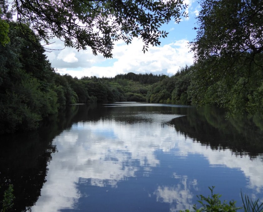
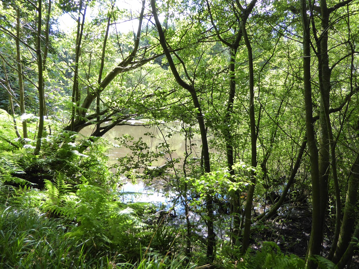
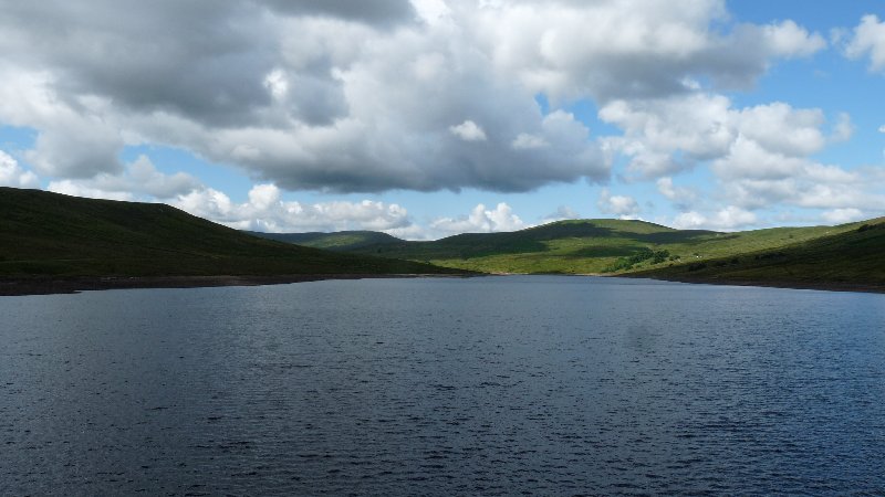
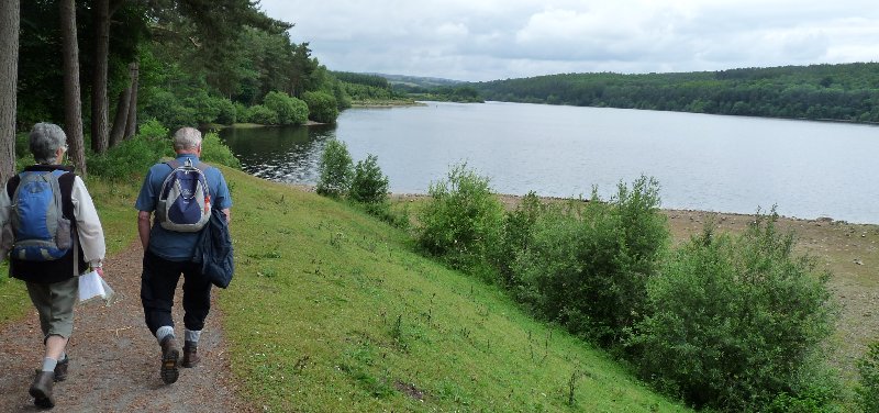
After I showed the photo that won me a popular vote a couple of years ago, some of you were kind enough to ask to see the one that came second. I’m pretty sure I may have shown it before, but here we are. It’s of a lake not too far from here: a wooded location that’s quite well known and appreciated hereabouts, despite not being tremendously accessible. Here’s Eavestone Lake in summer …
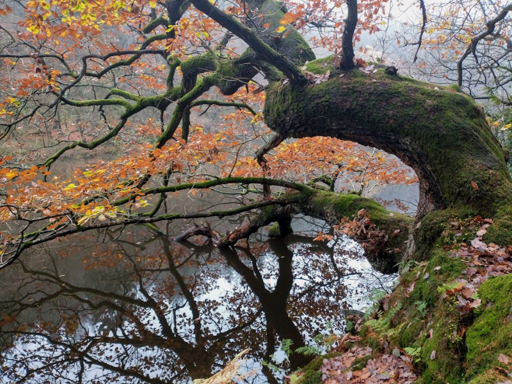
…. and in autumn, when the successful shot was taken…
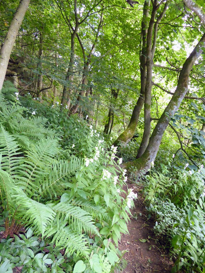
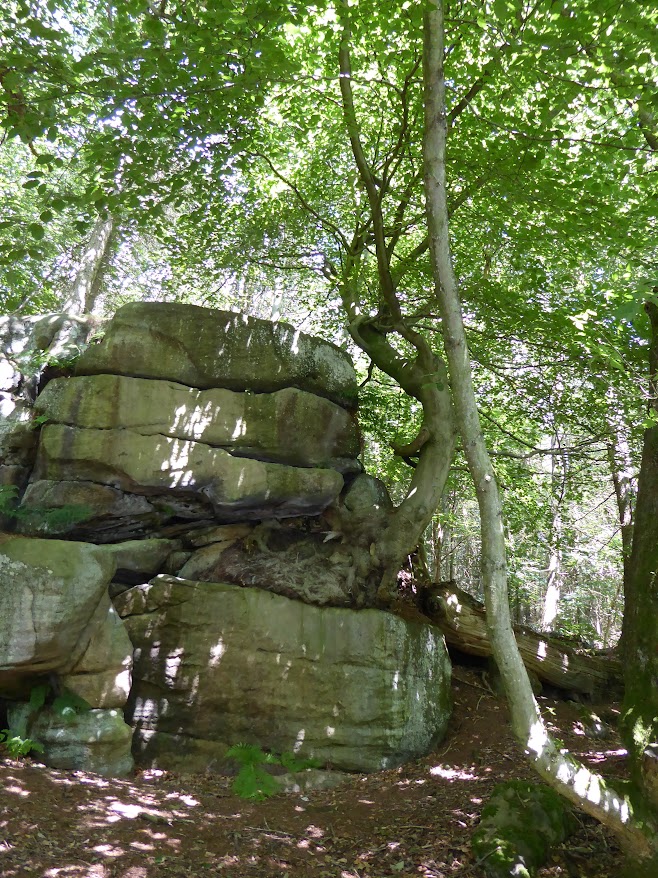
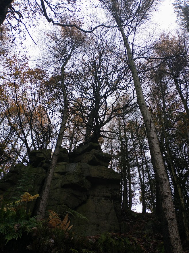
It’s set among rocks, to which trees sometimes cling tenaciously, and it’s hard to navigate your way through. Eavestone Lake may once have been a mediaeval fishpond for nearby Fountains Abbey. There’s even evidence that later, it may have formed part of a designed landscape: the lake has been dammed, and there are signs of careful planting if you know where to look (I don’t).
We once met an Oldest Inhabitant there, and he told us that the whole area had been almost entirely hacked back to the bone in the 1930s, for logging purposes. Abandoned, the trees took matters into their own hands to regenerate. They’ve done a pretty good job, I’d say. And they are part of a special area. Nidderdale Area of Outstanding Natural Beauty.
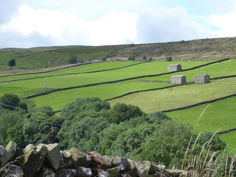
I love bleak. Typically rolling English countryside is lovely. And you can’t beat a verdant Daleside vista, criss-crossed with dry stone walls dividing its pastureland, its river along the valley floor edged with trees. But here in Yorkshire, every now and then, I have to have my fix of bleak.
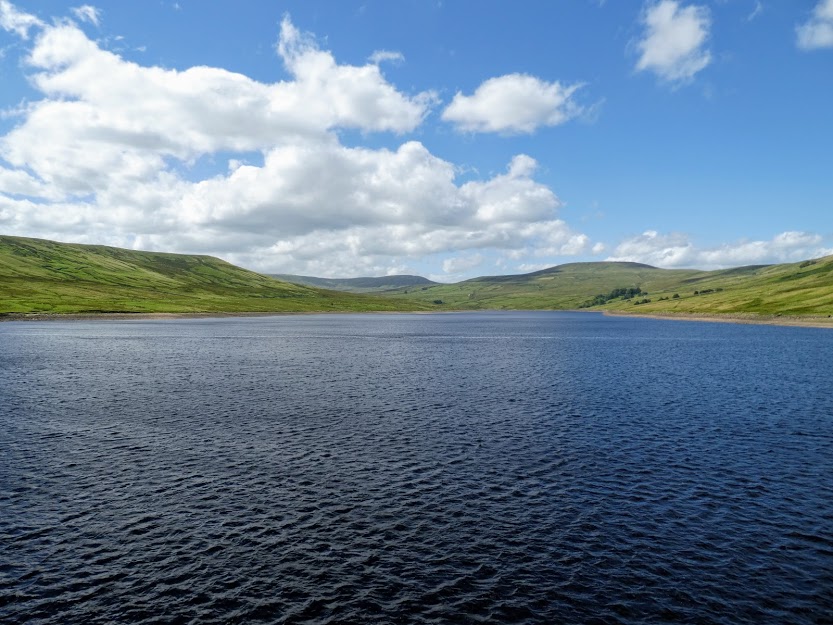
And one way to do this is to go over to Angram and Scar House reservoirs, both constructed in Nidderdale during the inter-war years last century, to provide water for the citizens of Bradford. Here are slopes, sculpted by long-gone streams and the often savage weather. These hillsides are covered in thin, tussocky grass – and not much else. Few trees. Few buildings – the odd hunting lodge or barn. But there are sheep, and birdlife too. One of our memories of walking here was once seeing a small meadow pipit struggling to feed ‘her’ baby, a cuckoo fledgling three times her size.
My friend Sandra and I went there this week. The day was perfect. Not too hot and not too cold. Briskly breezy. And as we arrived , the reservoir was as blue as we’ve ever seen it, almost cobalt in its intensity. We planned to walk our way round both reservoirs.
Scar House Reservoir
Which way though? Clockwise? Anti-clockwise? Sandra counselled clockwise, and Sandra won. That way, we’d get a slightly boring bit of track over and done with. We’d get the wind-in-our-faces over and done with. And most importantly, we’d get the squishier, less managed paths of Angram Reservoir over and done with.
It’s rained a lot lately, so walking round Angram involves some wet pathways. Not muddy, just paddleable. Juncus grass lining the route offered the odd springboard to drier grassy ground. But with water to right of us, bald barren hillside to left of us , the route is easy to see. And each reservoir terminates in a stout dam, each worthy of walk in its own right, and in Angram’s case, with water tumbling to its sister reservoir below.
Scar House Dam.
Angram Dam
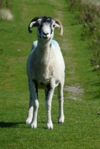
Finally we left our wet pathways behind, and joined the springier drier turf pathways of Scar House Reservoir where sheep kept us company.
But even though we knew from the car park that we weren’t alone, we felt that this particular expanse of hillside, sky and water was ours and only ours for the six and a half mile walk in the middle of nowhere.
As you walk the fells, moors and dales of northern England, this is what you’ll see.
Masham Moor from Slipstone Crags.
Miles and miles of drystone wall. In the Yorkshire Dales alone, there are some 8000 km. of wall, compared with only 990 km. of hedgerow, and 250 km. of fencing. These walls keep flocks of sheep contained upon a single fell. They provide a boundary between moorland heather and bracken, and more productive farmland. They divide one farmer’s plot into more manageable fields.
Off they march down the fellside, turning a corner and skirting the valley bottom, before cornering again to march back up. Or they’ll make snug little criss-cross squares in an ancient family farm. Well maintained or slightly ramshackle, they make Yorkshire and the Pennine counties instantly recognisable. Here’s a selection:
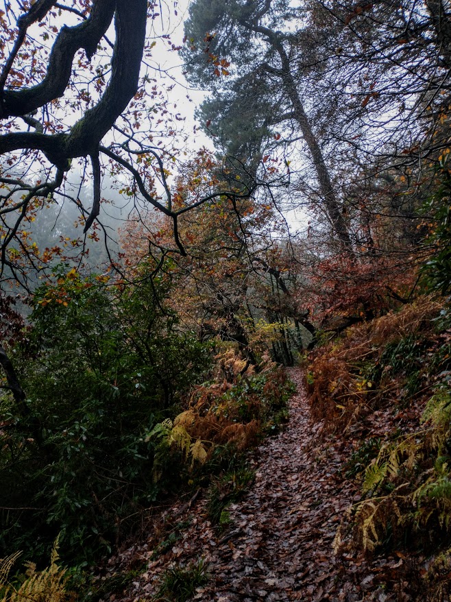
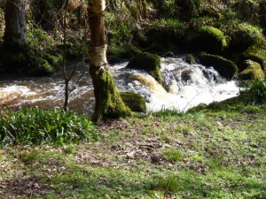
It wasn’t our best walk. Chris and I set off to ‘do’ part of the Nidderdale Way on Thursday. Thursday was fine. Wednesday hadn’t been. Nor had Tuesday. There’s been an awful lot of rain lately.
Even as we started out, we realised that mud was to be our constant companion. And water, trickling along slippery, sticky oozy paths. We forded streams which according to the map simply didn’t exist. If we wanted to go onwards, we had to wade through running water, or totter across from unsteady stepping stone to unsteadier fallen branch.
It was tiring. Finding not-too-soggy resting places was challenging too. We had our sandwiches in a wood alongside what should have been a babbling brook, but was in fact a raging torrent.
A normally quiet woodland stream.
And that’s when I noticed these stones – and trees. I’d expect boulders and branches like these to have a few tendrils of dry ash-grey lichen clinging to their surface. Instead they were thickly carpeted in vivid green. These specimens (and I don’t know what they are, despite a spot of Googling) were healthy, fecund and spreading very nicely thank you. It’s easy being green in such a damp, shaded and sheltered environment.
On Christmas day I posted a scene from our days living in the Ariège. I felt very nostalgic for the Pyrenees, for snowy peaks silhouetted against clear blue skies, for cold clear air.
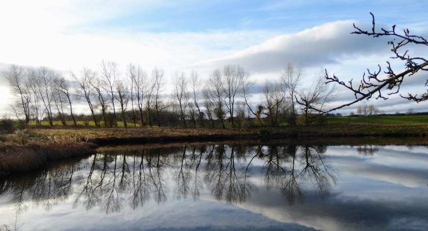
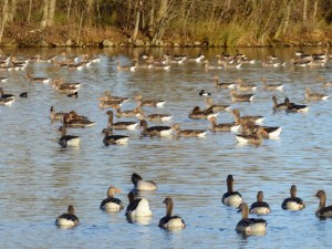
Today gave me the chance to remember that our countryside, though so very different, has its own charms and pleasures. We walked from nearby Masham and past the gravel pits of Marfield, now home to water birds of every kind: though only Canada geese and a few proud swans got a look in this morning.
We passed stands of ancient oaks, saw stark lines of skeletal trees marching along the horizon, watched the sky turn from Pyreneen blue to moody grey and purple then back to cheerful blue again. Sheep in late pregnancy cropped the short grass. We stopped to chat with fellow walkers walking off a calorie-laden Christmas. The River Ure was never far away. A pretty good morning’s work, actually.
I’m not so blinkered as to believe that Yorkshire has all the best bits of scenery. I’ve had days to recharge the soul in every English county from south to north, from west to east, enjoying stirring uplands, gentle verdant hillsides, sky-filled flatlands, slowly-flowing rivers and tranquilly tinkling streams, and the constantly-changing views from the beach at the seaside.
All the same, what we saw whilst out walking today gave every picture postcard of anywhere outside the Yorkshire Dales a run for its money.
John’s view of Yorkshire, as described on his T-shirt, is the correct one.
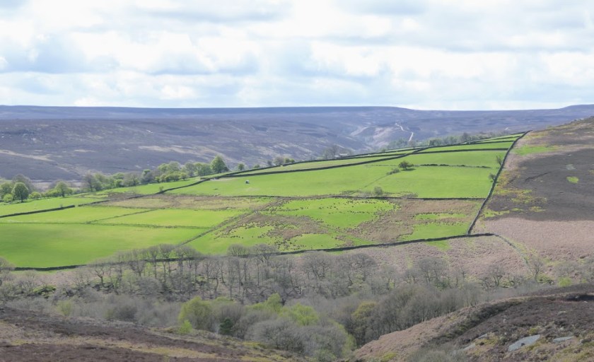
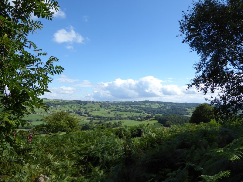
From Pateley Bridge, set in the heart of Nidderdale (Area of Outstanding Natural Beauty), we energetically panted and clambered through Guisecliff Wood, whilst looking down at the village of Glasshouses below. We emerged, puffing for breath at the top, One way, we could look across the Daleside landscape of ancient field systems and stone-built settlements, to the vale of York beyond.
Looking across towards the Dales.
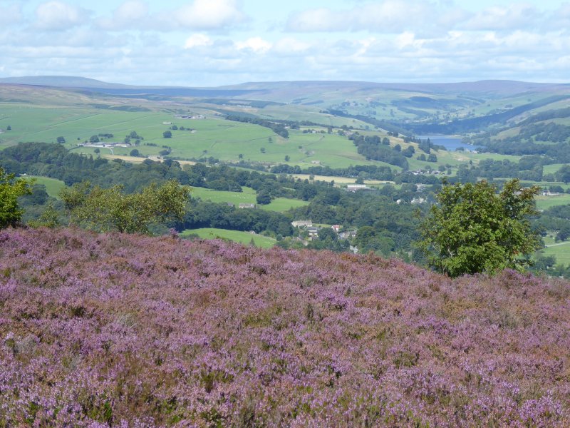
The other way were the moors, no longer bleak, because this is heather time. We breathed in the intoxicating smell that I like to buy potted up as rich, almost peaty flavoured heather honey. We stared, almost mesmerised at those carpets of blooms stretching away from us, mile after mile: not lilac, not lavender, not violet nor damson – simply that special low-key subtle purple that only heather can deliver.
Marching through the heather.
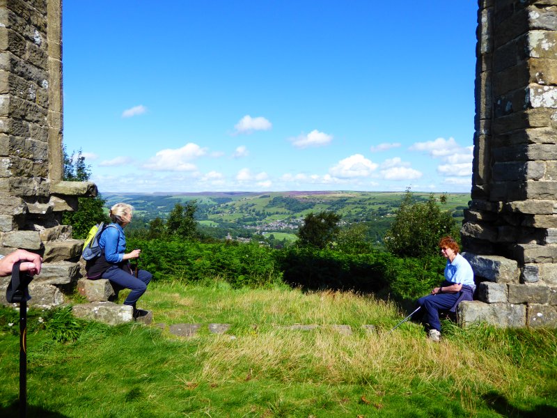
Past Yorke’s Folly: it’s said it was built in 1810, commissioned by the local landowner, John Yorke of Bewerley Hall, who was casting about for some means to keep his labourers in employment in a time of economic depression. These men received a shilling and a loaf of bread a day for their efforts.
Yorke’s Folly: a resting place for weary walkers to enjoy the view.
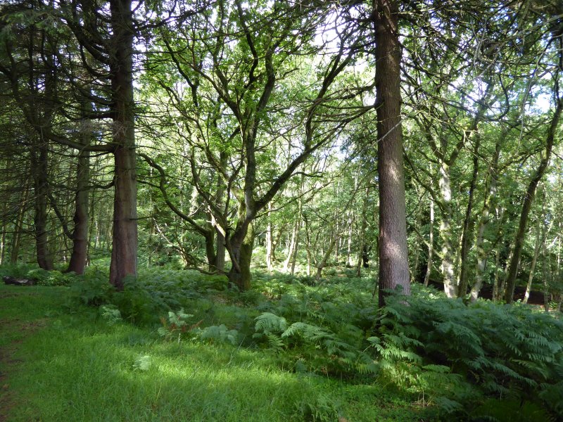
Then it was back to woodland again – very English woodland, with a full green canopy, not yet ready to turn to autumnal colours. Skrikes Wood, Nought Bank, Fishpond Wood.
Skrikes Wood.
Then back along a few final paths before returning to Pateley, and a very welcome pub lunch.
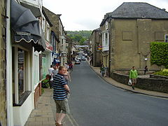
Pateley Bridge, population just over 2,000, is slap in the middle of Nidderdale, an AONB (Area of Outstanding Natural Beauty) appreciated for its landscapes, its rich flora and fauna, and its now hard-to-spot industrial past. But if you were there this last weekend, it might not have been to use the town as a base to explore the Yorkshire Dales. You might instead have been coming to Niddfest, a new family-friendly festival offering a weekend of talks and outside events for nature lovers, and especially book-loving nature lovers, of all ages. That’s why we went, on Saturday, and again on Sunday. We had a pretty busy weekend there, but it turns out we weren’t busy enough.
Pateley Bridge High Street (Wikimedia Commons)
We weren’t there when Poet Laureate Carol Ann Duffy and National Poet of Wales Gillian Clarke introduced the festival, reading from their work. We were absent from the sessions when the likes of Piers Torday, Katharine Norbury and Michelle Harrison were reading from and discussing their books. We didn’t go on the Moor Safari, or on the river walk along the Nidd, or foraging for wild edible plants. We didn’t commandeer our grandsons so they could explore for bugs at Studfold Adventure Trail, or go den-building in the woods.
Scar House Reservoir, scene of our bird-watching walk.
What we did do was go on what was billed as a bird-watching walk with Mark Cocker and the Nidderdale Bird watchers’ group. And what a way to start. A young cuckoo landed on a fence post, and was immediately followed by his unwitting foster-mother, a meadow pipit, who spent frantic moments stuffing food down his always-open throat. Bear in mind that a meadow pipit is some 15 cm. long, and weighs in at 15 g . The cuckoo wasn’t far from its adult size of 33cm, and 110 g.
With a start like that, the rest of the morning might have been a let-down. But it wasn’t. We saw an old shed where a colony of swallows had begun their days, and learnt that they, like most swallows, would end up wintering in a reed bed somewhere near Durban, South Africa…. some twelve and a half thousand kilometres away. We saw house martins, goldfinch, and quantities of ‘red’ birds – red kites, redpolls, redstarts. We learnt to distinguish thistle varieties, and learnt which ones bees favour. We began to understand just how many varieties of bees, beetles, flies and other insects populated this limited corner of Nidderdale. All this thanks to the bird watchers and especially to Mark.
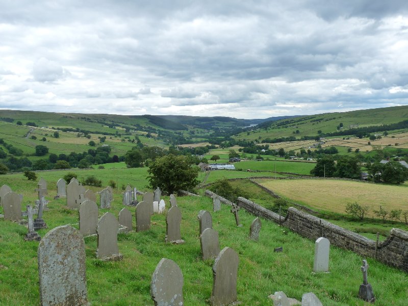
Then we hurried up to Middlesmoor – to hear Mark again, in conversation about his books. Do look at his website – here – to learn more. His nature writing is something special. He celebrates wildlife in its day-to-day environment, but believes the natural world is far more than an interesting and quite engaging backdrop to our lives. It’s fundamentally important, and environmental issues need to assume an equal, if not a greater importance in political decision-making than, for instance economic affairs. Instead, they are sidelined if not totally disregarded.
Middlesmoor churchyard.
This politics-with-a-small-p approach continued the next day, when we heard Oxford graduate and Cumbrian shepherd James Rebanks speak about his bestseller ‘The Shepherd’s Life’. He has many strings to his bow (adviser to UNESCO for instance) – farming in the Lake District simply doesn’t pay. He points out that our desire for cheap food, our disconnection from where our day-to-day nourishment comes from is putting traditional farming, where animals are treated well and with respect at risk.
And then it was Rob Cowen. How could we not be fascinated by his book ‘Common Ground’? He has become forensically interested – almost obsessed – by a small patch of green space just at the edge of Harrogate. This small area was our own ‘green lung’, only yards away from our front door when we too lived in Harrogate. He weaves the story of his growing infatuation together with more personal notes about the baby he and his wife were expecting. It’s clear his well-being depends upon his developing close relationship with this edge-land, this little piece of woodland, river and grass still clinging on to the top corner of a busily expanding town. Nature writing with a difference.
What a rich feast we had. In some ways we’re sorry we didn’t cram in more of what was on offer. But as you see, we had more than enough to digest. A brilliant festival. It had better come back next year.
Starting round Swinsty reservoir. It’s not raining yet……
Reservoirs. If you live in the city, you’ll be dependent on one, almost certainly. Every time you turn on the tap, the water that come gushing out will have started out in some far-flung and distinctly rural part of the area.
These days, reservoirs aren’t just – er – reservoirs. They’re playgrounds for all of us – walkers, dog-walkers, fisherfolk, bird-watchers and naturalists of all kinds. They’re protected and protective habitats for all kinds of wild creatures. And in their watery depths, they conceal their history. Those reservoirs built between the 1860s and 1960s conceal drowned ancient villages, mills, factories, farms and country estates, leaving almost no trace behind. It’s hard to believe that the 4 reservoirs of rural Nidderdale hide a once-industrial area, where iron smelting, woollen fulling (a process something like felting) and flax-making took place, and where, in the early 19th century, the demand for labour was so acute that pauper children as young as nine were recruited from London to keep the factories working.
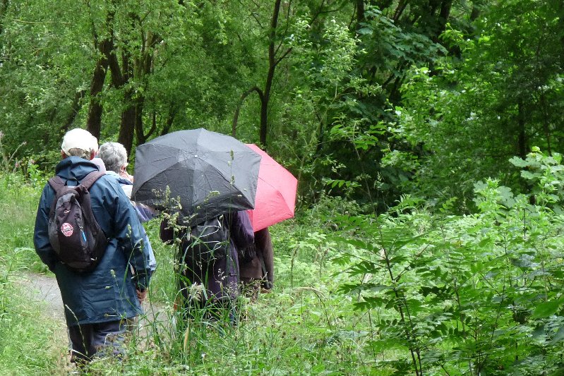
We Ripon Ramblers went off yesterday to walk a figure of 8. Park at Swinsty Reservoir, walk all the way round adjacent Fewston Reservoir, back to Swinsty again and walk round there. You can see from the pictures that the early promise of the day was not maintained. It rained and showered a lot. But rain and showers make for picturesque views.
An umbrella or two: the ideal accessory for an English walk.
Fewston reservoir.
Geese of all kinds populate the reservoirs in huge numbers.
Fewston just as the rain sets in.
Fishermen don’t seem to mind the weather.
Flowers of high summer at the lakeside.
A very rainy view.
A leaden sky.
Walking through the woods. A fine canopy against the rain.
Looking across Nidderdale.
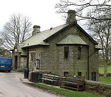
Oh, and at the end, we took a small diversion to visit the old and picturesque village of Timble. It may seem like many a charming Yorkshire village, but it has a bit of extra history on the side, in the form of the Robinson Library. This building was the gift of Robinson Gill of New York, in 1892. He’d left Yorkshire in 1851 for America to seek his fortune. He found it: he had two successful stone yards on the Hudson River and was president of two New York banks.
His ancestors were prosperous yeoman who had lived in nearby Swinsty Hall, and he himself had been born and raised in Timble. From his adopted home in the States he arranged an endowment of £2000 to pay for a teacher for the school and for the upkeep of the building, and laid out £100 for books. The library provided the villagers with not only a library, but a free school, a Sunday school, a social centre and a reading room. The endowment failed with Robinson’s death: his descendents weren’t as astute about money as he had been, so the library fell on hard times for a while. The children now travel elsewhere for their schooling – after all, the village only has 100 inhabitants – but a recent programme to restore and re-invigorate the building means it is once more an active social centre for the community and beyond.
The Robinson Library, Timble. (Wikimedia Commons)
So, dear American readers, come and discover the area for yourselves, with its unexpected link to your part of the world. You could stay at the Timble Inn, an 18th century coaching inn, and then discover not only those reservoirs and their hidden history, but the towns, villages, dales and moorland of Nidderdale. You’ll be glad you did.
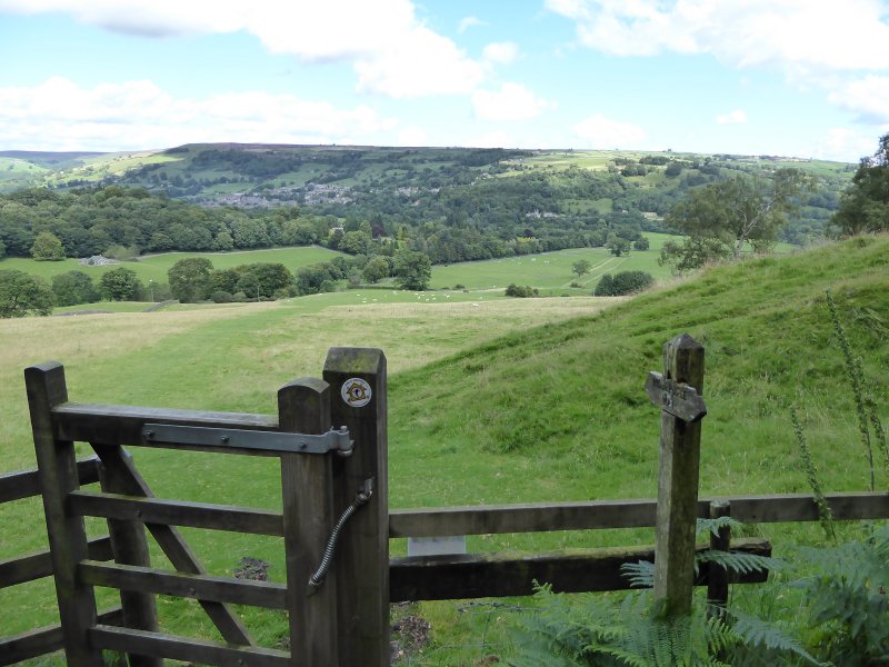
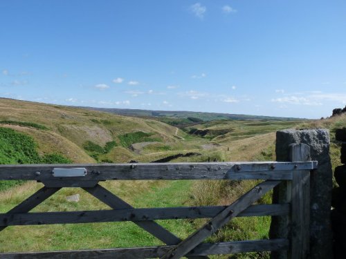
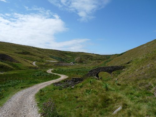
Take a walk through much of rural Nidderdale in North Yorkshire, and almost the only sign of human endeavour that you’ll see is connected with agriculture. Go out into this lightly-populated area, with its apparently nearly barren hillsides, and you’re only likely to meet sheep, with the occasional field of cattle.
Yesterday, we went to Greenhow. It’s a charming, pretty village more noted these days for being the highest village in Yorkshire: a whole 400 metres or so above sea level. It used to be an industrial power-house. It was here and in the surrounding area that villagers used to mine for lead. And the signs of this ancient industry are still here. We set off on a walk across moorland and valley to investigate.
It’s thought that the Romans were the first to mine lead in the area, and by 1225, the abbots of Fountains and Byland Abbeys were apparently squabbling(!) over rights to mine at nearby ‘Caldestones’. This valuable commodity was transported over, for the time, immense distances. In 1365 for instance, a consignment was sent to the south of England, to Windsor: ‘Two wagons each with ten oxen carrying 24 fothers* of the said lead from Caldstanes in Nidderdale in the county of York by high and rocky mountains and by muddy roads to Boroughbridge’. At which point, the journey perhaps continued on water. Indeed, lead was exported as far afield as Antwerp, Bordeaux and Danzig.
An all-but hidden tunnel.
Peering into it. We were too tall to stand upright.
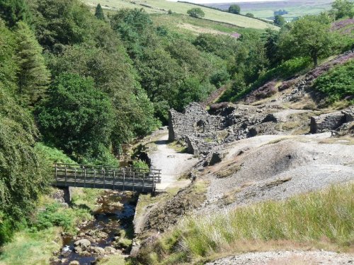
What’s left of an old lead works.
The beginnings of a long journey for that now-smelted lead.
Well, we were on those ‘high and muddy mountains‘, but they didn’t cause us too much trouble. Comfortable walking boots and a bright sunny day probably helped us on our way. What we did see were warrens of carefully constructed and stone-lined tunnels leading to the ancient and now fully-exploited lead seams. We saw, in the small streams now coursing along some of them, how water became a real problem to the miners of those seams. Horse tramways hauled lead , which was smelted on site, off to what passed for major roads at the time. It was obvious to us how very difficult transport must be in this up-hill-and-down-dale area, which even than was not highly populated, with poor transport infra-structure, and unsophisticated wooden carts to carry the goods. Ancient spoil-heaps from now-exhausted seams litter the area.
An old lead-works, spoil heaps, a river and a perfect picnic spot.
And at the end of our journey, we strode up to Coldstones Cut. This is a fine art work, a vantage point from which to see a vast panorama of the Nidderdale Area of Outstanding Natural Beauty and beyond, as well as the last working quarry in the area. These days, it’s all about aggregates and asphalt, but the quarry has a long history of providing lead, then limestone as well as other materials. Andrew Sabin‘s viewing area is part streetscape, part brutal stone-block construction. It’s a magnificent intermediary between an immense and busy industrial landscape, and the gentler and even vaster rural one in which it’s situated.
Even at Coldstones you can’t escape the legacy of the Tour de France.
The quarry: hard to convey a sense of its scale.
That qualifies as a mountain round here.
A view from Coldstones.
That’s Nidderdale.
The monumental viewing area.
…and from another angle….
Nidderdale again.
A final view.
*An old English measurement equalling about 19.5 hundredweight.


You must be logged in to post a comment.