At the Edge of the North York Moors

Sunday. A day that promised sunshine, maybe showers. A day to get out of the house somewhere a little more distant and explore.

My friend Sandra and I picked Boltby. It’s on the edge of the North York Moors, but fertile farming country, transected by rippling streams and glades of trees. Before setting out, we found a wonky-lozenge-shaped network of paths that would take us to another village – Felixkirk – in time for lunch before returning us, wonkily – to Boltby on the other side of the lozenge.

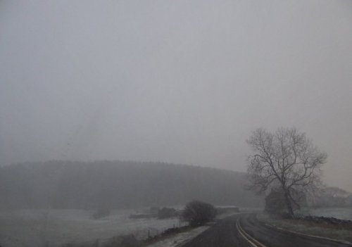
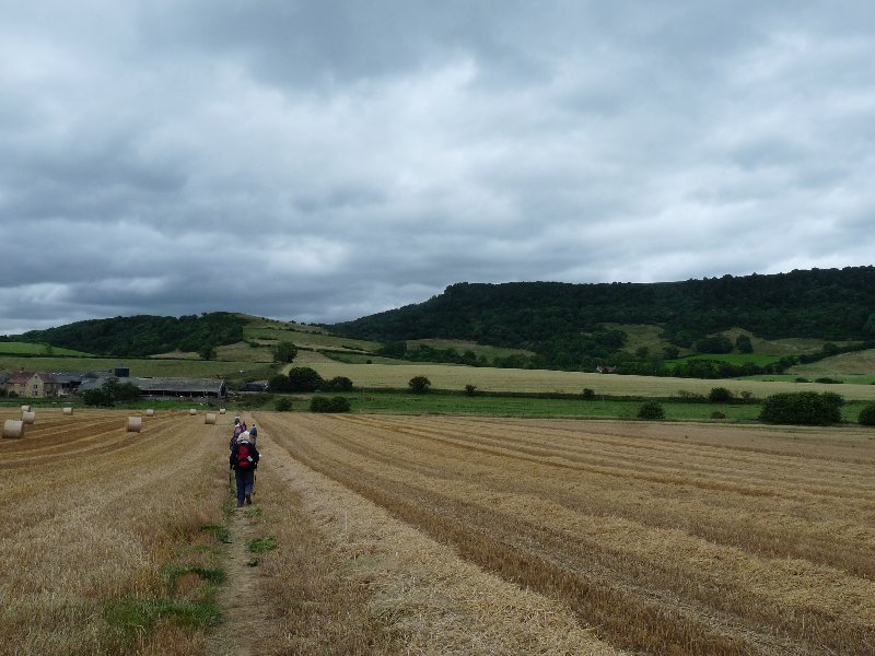
The feature photo shows how the walk started. Honestly, it wasn’t as grey as it appears. Just moodily misty: a warning that it might – just might – rain. It didn’t.

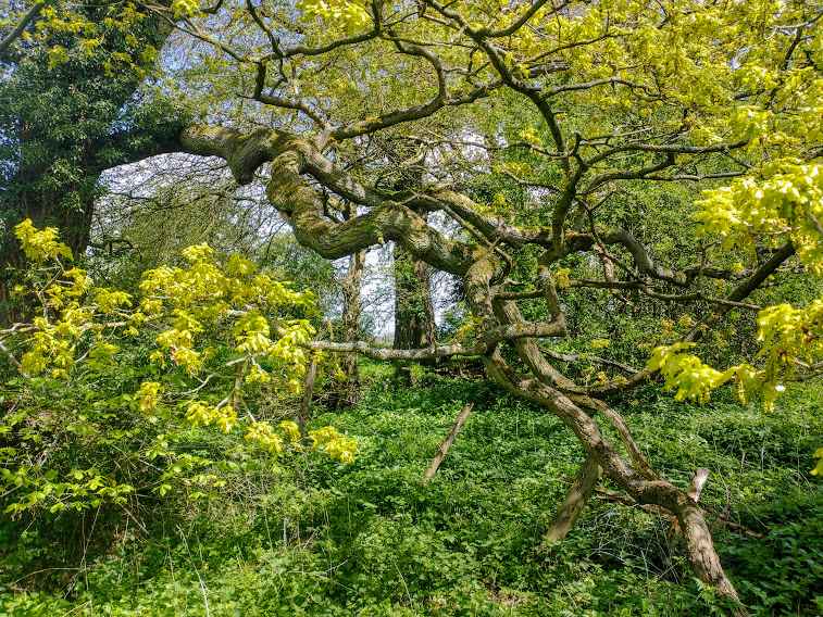
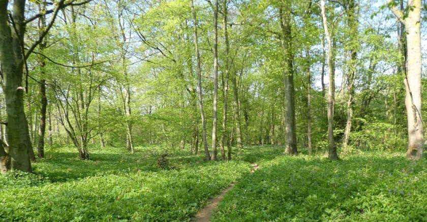
Instead, we enjoyed noticing how the gnarled and characterful trees were at last springing into leaf: bright and sappy.

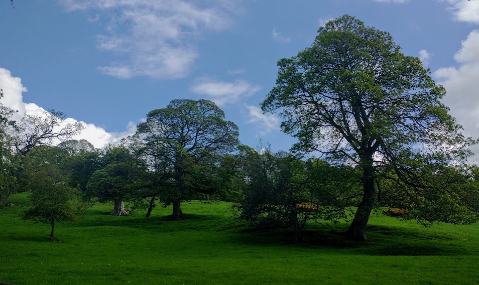
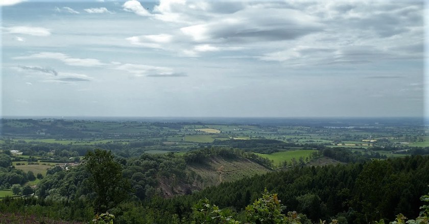
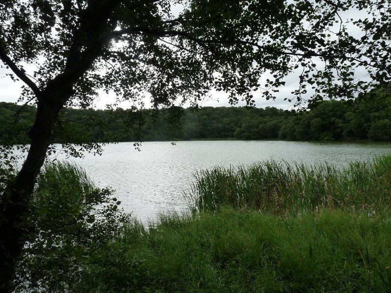
Our feet bounced along on the springy (though wet) turf, and we made good progress until we hit a series of stream-crossings. I should have taken photos of the battered little bridges, in once case so falling-apart that we forded the waters instead. We should have recorded evidence of stiles so past their use-by date that they swivelled and see-sawed as we tried to use them. We soldiered on. By now the mists were gone, the sun was out, and this was the scene.

Then Felixkirk. We sat with our sandwiches on the village green and enjoyed watching the villagers strolling towards the village hall with offerings of scones, sausage rolls and cakes of all kinds ahead of an afternoon dedicated to celebrating Saturday’s Coronation.

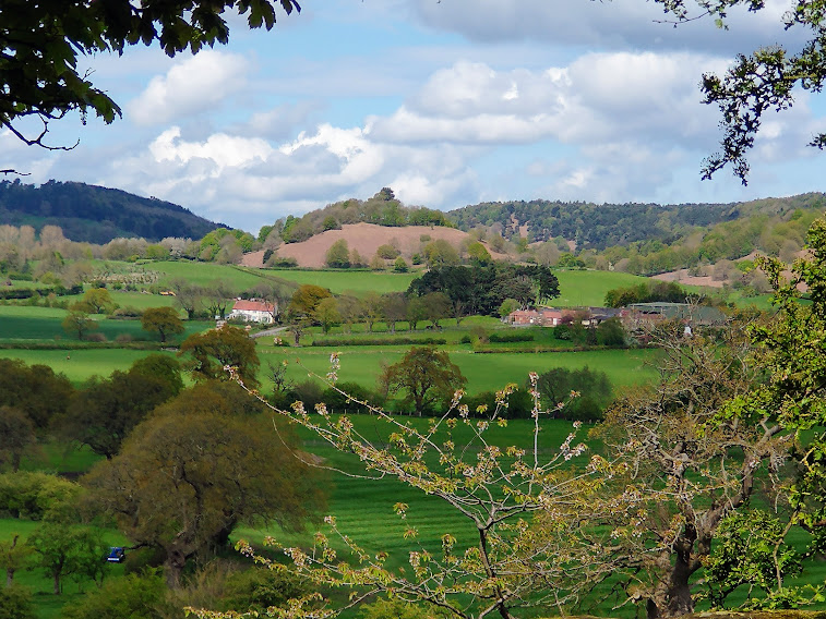
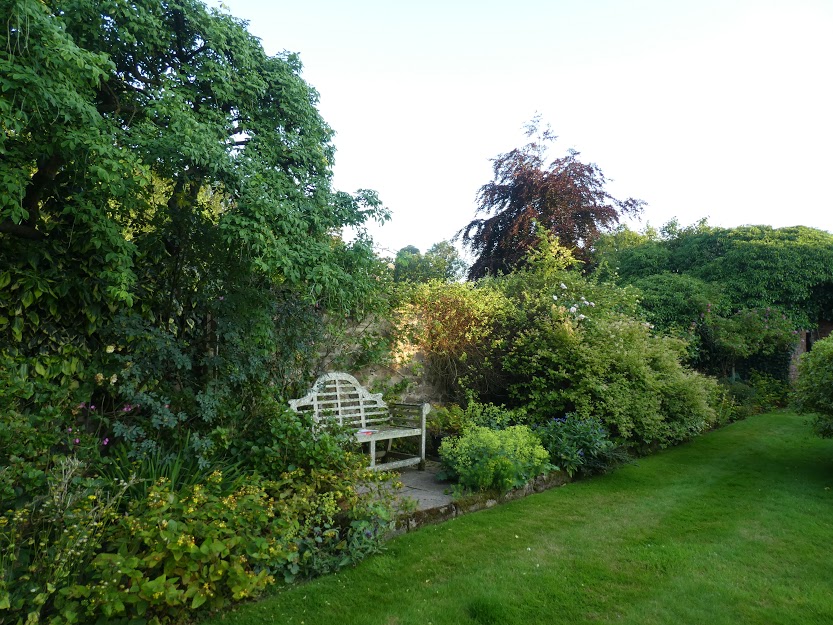
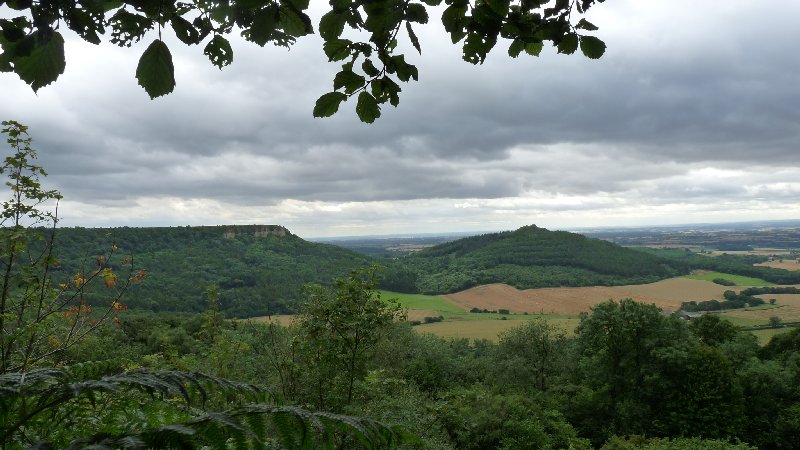
After lunch, the walk became more open, with long-distance views. We were on the home straits, with one more village – Thirlby – in our sights.

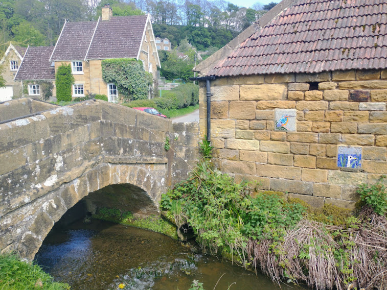
Then finally – back to Boltby, with a spot of bad planning: a hill at the very end, just after crossing its ancient pack-horse bridge.

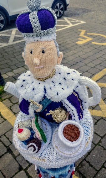
But Boltby has no teashop. To Thirsk then – after four o’clock. All tea shops closed. So instead, we bought ginger beer, and sat on the market square enjoying the Coronation yarn bombing. At least King Charles had his cup of tea. And cake.

Here’s the walk we did. In our opinion (that of Sandra’s app anyway) it was just shy of 10 miles. A good day out.

For Jo’s Monday Walk.

Quiet Moments

When all this is over, I’ll remember the quiet moments …

… the early evenings in the garden, as the birds chattered tunefully among themselves …

… the woodland walks, where I was soothed by the changing patterns as, day by day, green leaves unfolded above me, and the flowers of spring, then summer, came and went alongside my path.

And I’ll remember this walk too, from Monday this week, when I exchanged my bosky local landscape for the wider vistas near the North York Moors National Park, where a long slog up a long hill rewards with far-ranging views. And maybe the chance to take a photo requiring depth of field, for Jude’s current photo challenge.

Lens-Artists Photo Challenge #102: A Quiet Moment


The White Horse at Kilburn

Here in England, we’ve got a bit of a thing about images of a white horse cut into the hillside.  There are well over 20 of them, from the South Downs to Wiltshire, via Leicestershire and even as far north as Tyneside.  We like to think many of them are pretty ancient, like this one, the Uffington White Horse, first carved into the hillside chalk of Oxfordshire: probably in the Iron Age, possibly as long ago as 800 BC.  But they’re not.  Most of them date from the 17th, 18th and 19th centuries.

Uffington White Horse (Wikimedia Commons)

We’ve got our own white horse here in North Yorkshire, near Kilburn.  It’s really rather modern.  Back in 1857, a Kilburn-born man, Thomas Taylor, who’d become a provision merchant down in London thought that his home village should have its very own version of the Uffington White Horse.  He got John Hodgson, who was the local schoolmaster, together with the schoolchildren and a band of volunteers to cut a horse shape from the turf to reveal the sandstone beneath.  Six tons of lime were used to whiten the image, which can be seen from many vantage points in North Yorkshire, and on a clear day, from as far away as Leeds, 45 miles away, and even North Lincolnshire.

Kilburn White Horse (Wikimedia Commons)

And that’s where we went yesterday for an energetic nine mile walk.  Our path took us along scenic Beacon Banks.  Once it had a beacon at its summit to alert the country when danger threatened.  It warned of the approach of the Spanish Armada in 1588.  It was a watching point for the Home Guard during World War II.  Now it’s simply a lovely place from which to survey the countryside. Our route took us past three of the prettiest villages in this part of the world – Coxwold, Husthwaite and Kilburn – through woodland, through farmland with views across to the Vale of York, the Hambleton Hills and North York Moors, passing ancient Norman churches we couldn’t call into because it was Sunday.   And the White Horse – often there as a backdrop to the scenery. Here are some picture postcards of our day.

A day beside the seaside

You’ll know that we waved ‘Goodbye’ to Emily this week.  She’s arrived in South Korea,  jet-lagged and exhausted, but not so much that she can’t send snippets of up-beat information about her new life as Emily-in-Busan.

While she was with us, Emily-in-Barcelona briefly became Emily-in-London, Emily-in-Bolton, and Emily-in-Yorkshire. And while she was with us, Boyfriend-from-Barcelona came to visit.  What should we show someone from a vibrantly busy city, one of whose attractions is several kilometres of golden, sunny, sandy beaches?  Well, on a frosty, gusty February day, with more than a threat of snow in the air, what could be better than a day beside the seaside?

Whitby: the view anyone who's been there would recognise.
Whitby: the view anyone who’s been there would recognise.

Whitby seemed to fit the bill.  Picturesque fishermen’s cottages huddled round the quay.  A clutter of narrow cobbled shopping lanes – a tourist mecca to rival Las Ramblas.  A sandy beach with donkey-rides, and the chance to find fossil remains etched into the cliffs or a morsel of jet washing about on the sands.  A ruined Benedictine Abbey high above the town, the inspiration for Bram Stoker’s ‘Dracula’, and the focus of a twice-yearly Goth music festival.  And fish and chips.  Always fish and chips at an English seaside destination.  Emily and Miquel explored the lot.

And Miquel, windblown and chilled to his fingertips, declared that it had been a fine day out, with the added bonus of being firmly inside the car when we journeyed home across the North York Moors as the snow began to fall.

Best to be back in the car when the weather's like this.
Best to be back in the car when the weather’s like this.

Struggling down and up Sutton Bank

Looking down from Sutton Bank.

My goodness.  I haven’t been on a walk like that since we left the Ariège.  Over there, in the foothills of the Pyrenees, you knew you’d very likely have to struggle up and down through at least 600m in the course of a day’s march.  Over here in Yorkshire, the hills and dales are generally much more forgiving, and I’ve got unused to climbing…. and descending.

All that changed yesterday.  We went to Sutton Bank.  You know what you’re going to be up against even before you arrive.  The main road leading to the top has a gradient of 1 in 4, caravans are banned, and HGVs regularly get caught out on the way up.  Yet the summit is a mere 298m. above sea level.

But it really is all about the gradient, this walk .  And the wind.  Not for nothing does the Yorkshire Gliding Club site itself at the top of the escarpment, all the better to enjoy the wind, the thermals and the views over North York Moors National Park.  It made for an entertaining beginning to the walk, watching gliders being towed to a height of 600m. before being detatched to begin their slow and graceful descent to earth.

A glider is towed upwards on a windy day.

P1210070But this walk was all arse about face to someone accustomed to those Ariègeois walks.  There, you started at the bottom, panted doggedly till you got to the top, where you had lunch, and then you skittered down again.  Yesterday, we started at the top, and having waved the gliders goodbye, set off down the escarpment, through English woodland, with tantalising views across to the plain beneath.  It wasn’t as mad as it seemed though.  The path was steep enough to be slippery and uncertain, and it felt good to do this while we were still fresh.  Climbing, later in the day, though tough, was the lesser challenge.

A level walk across the fields.

Soon after our lunch break, we were striding across fields set about with recently harvested bales of straw and hay, enjoying the views .  This was to break us in gently for a thoroughly vertical-seeming climb, with steps among the tree roots to help us upwards.  About half way up, we had a reprieve, because  extraordinarily, there is a lake.  Lake Gormire was formed in the last ice age, when  a gigantic ice sheet scoured out a deep hollow in the crags.  The southern end got trapped by landslips, and water from springs at the base of the escarpment allowed water to collect.  It’s a lovely, secret place, and a haven for wildlife.

Lake Gormire.
Lake Gormire.

A final effort, and we were there, at the top of the escarpment once more.  A short walk along the top brought us to journey’s end, but not before we had stopped to admire the view which locals modestly call the finest view in England.  Well, it’s certainly very fine.

Almost at the top of Sutton Bank and journey's end.
Almost at the top of Sutton Bank and journey’s end.

We were glad to have had this challenging walk.  Our muscles and air-waves reported they’d had a fine work out.  We should do this more often.