Today, I rejoined the human race. For the first time since before Christmas, I got up, got dressed, looked out of the window – and wanted to be out there, in the bright and frosty sunlight. Malcolm’s recovery is a good day or two behind mine, but I hope that he too is on the way up.
An early morning frozen pond
The first snowdrops
Frosty thistles
The promise of daffodils
Eleven o’clock shadow
Blue sky January
The sky reflected in the River Ure
Frosted leaves
Those Jacob sheep supervise me home every single walk.
I wasn’t up to a hike. I wasn’t even up to a stroll to the village shop, only a mile and a half away in West Tanfield. But I was up to a riverside amble, particularly when it meant coming upon little clumps of snowdrops on the woodland floor, already unsheathing their white faces to greet the winter sun.
Snowdrops push above the leaf mould
If the snowdrops are out and about, truly, all’s right with the world.
Ever since our friend Micheline had a nasty fall on a walk, three and a half years ago, and had to be air-lifted to hospital, I’ve been slightly wary of walking alone in the countryside.
But sometimes, only solitary will do. Never more than 4 miles from a village, always with a farm somewhere not too far away, I set off for a solo walk this morning, even before all the Grammar School pupils had got on their bus to whisk them off to school in Ripon.
From your point of view, as you look at these photos, you may feel it was all just a repeat of my Sunday morning stroll. But it wasn’t at all, not for me. My path drew me in a big eight mile circle to the west of our village. It took me past a working quarry: always good to watch men at work. It took me past ancient trees: our home patch is particularly good at oak trees which are very old indeed. As I was passing through a wood, an anxious Wensleydale sheep cantered up to greet me. I saw why she was worried. There wasn’t another sheep like her in sight anywhere – she was lost. But I never found anyone I could report her to. I hope she’s alright. There were fungi. There were delicate and skeletal winter seed heads. I saw a pint of milk delivered to someone’s gate, and took a picture of it. Home milk delivery’s getting scarcer here now than it was in my childhood, but I’ve never seen milkmen in other countries I’ve visited. I saw Autumn leaves still clinging to the trees, and plenty more in vibrantly coloured heaps at the base of trees.
Best of all – and I have no photo to prove it – shortly before the end of my walk, as I was climbing steeply through woods with the River Ure below me, three white-rumped deer leapt out of a clearing, and with three rapid yet elegant and beautifully choreographed bounds, disappeared from view, only to re-appear and disappear for good, moments later.
All in all, a pretty good use of a Friday morning, I thought.
Winter birds
Leaving home under the watchful eye of the Jacob sheep
An early morning sky
Big machinery at the quarry.
An ancient oak
This woodland will be deep in bluebells next April
What a difference a week makes. This time last week, Amelia and I were ‘recce-ing’ the walk I was due to lead this Tuesday, stumbling around near Swinton trying to make sense of a map and a warren of pathways. Both reasonably competent map-readers, we found ourselves confronted by too many cross-paths, and too many waymarks that didn’t QUITE make things clear enough. We got there in the end, of course, having met in the course of our journey several equally puzzled hikers turning their maps every which-way as they tried to choose the correct route.
This week, I competently led seven Ripon Ramblers on the walk and wondered why we’d found it all quite so difficult. But it got me thinking about all those paths. Paths are created by those who use them. Roads were too, once upon a time, as all those single track and often ill-repaired ‘C’ roads meandering from village to village testify.
But these days, roads are planned. It’s town planners, the Highways Agency, and whole bevies of committees who decide where roads will go, and how they will get there. If they deem it necessary, they will flatten hillsides or even communities that stand in the way.
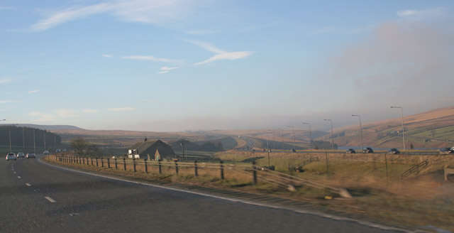
Usually. There’s that famous farm in Calderdale which parts the two carriageways of the M62, the motorway which links Yorkshire with Lancashire. Legend has it that at the planning stage, the farmer refused the blandishments of every official from the Department of Transport, every civil servant who tried to persuade him that The Road Must Go Through, till finally Officialdom gave in and built the road around his farm. Sadly, it’s not true, and you can read about it here Still, whatever the truth of the story, it nicely illustrates the fact that these days, road are normally built where planners decide.
Stott Hall Farm in the middle of the M62. Photo courtesy of Wikimedia Commons
With paths, it’s a different story. Those routes that we use every time we go out walking in the country were chosen by those who did the walking, often many centuries ago. Well-trodden paths that have linked communities over the years are public rights of way that have to be kept useable and maintained by local councils in just the same way as roads must be. Local authorities have a duty to ensure that they are useable by installing gates and stiles to enable users to, for example, cross from field to field. Landowners who wish to vary the route of a path must have good reason, and must provide for and maintain a viable alternative.
On Tuesday, we went along a whole variety of paths, as we always do when out walking. Some were fine tracks covered in chippings and linking farms. One path was straight and wide with fine stone foundations: once it was a railway line built to haul goods to a reservoir under construction in the early 20th century. But much of the time, we could pick out our routes across farmland only by observing a sinuous line of flattened grass where others had walked before us. I enjoy knowing that most of these paths, whatever kind they are, have often been used for decades and even centuries before.
Needs can change though. That day when we first tried the walk Amelia and I had a dreadful time looking for a certain path. We even ended up at a farm asking for directions. ‘You’ll never find it’ we were told. ‘Nobody’s used it for ages, and it’s hopelessly overgrown. You’d much best use the road’. Well, it didn’t really suit us, but we could see why it had happened. The road was more direct than the old path so people ‘voted with their feet’ and stopped using it.
We’re pretty lucky to have a great network of paths. And besides that, in large areas of the country, we have ‘the right to roam’, meaning we’re free to explore the open countryside away from paths, following the Countryside and Rights of Way Act, introduced in 2000 after a 60 year campaign. I’m enjoying those paths, whether mooching, walking purposefully, exploring, or simply ‘following my nose.’
A grassy path.
Once this was a railway track.
A path that’s a road as well.
A stile on a path.
A path through a field.
A path that’s a bridge.
A finger post points out the path.
The Ramblers association does much to promote the interests of walkers and protect the walking environment.
We travelled the road to our last walk in thick white mist, fearing a dank and gloomy day. But the higher we climbed, the more the mist fell away, and the brighter the sun shone.
Looking down over Wensleydale from Castle Bolton.
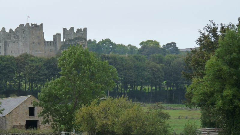
This was the scene as we arrived at Castle Bolton, the village where you’ll find Bolton Castle:
And as we began walking, Daphne shared some of the castle’s history with us. It has belonged to the Scrope family since the time it was built in the 14th century, and has always been admired for its high walls. It’s a proper castle, looking exactly like the ones you will have drawn when you were eight years old.
Bolton Castle
But that’s not why it secured its place in the history books.
Tudor history is largely about the constant religious and temporal battles between the Catholic and the Protestant church, which Henry VIII had made the Established Church, with the king as its head: the Fidei Defensor – Defender of the Faith (unbelievably, Henry hung onto this title, awarded him in his pre-Protestant days by Pope Leo X, in recognition of his book Assertio Septem Sactramentorum which defends the supremacy of the pope). His son Edward briefly succeeded him, and then his daughter Elizabeth, and both were Protestants.
But Elizabeth’s rule was threatened by the Catholic Mary Queen of Scots, and she was held captive first at Carlisle Castle, then at Bolton. Here she was attended by 51 knights, servants and ladies-in-waiting, not all of whom could be accommodated in the castle itself. She also had cooks, grooms, a hairdresser, an embroiderer, an apothecary, a physician and a surgeon, while furnishings fit for a queen were borrowed from nearby Barnard Castle. She went hunting, learnt English – for she spoke only French, Scots and Latin – and spent time with local Catholics. She made an unsuccessful bid to escape from captivity. It’s said she climbed from an upstairs window in the castle, and fled on horseback past the nearby market town of Leyburn. It’s here she dropped her shawl and so was discovered and recaptured. And that is why, so they say, the long escarpment above the town, nowadays a playground for walkers and sightseers, is still called ‘The Shawl’.
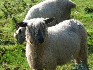
As we enjoyed our history lesson, we passed a field of Wensleydale sheep. We very much admired their sultry fringes.
Wensleydale sheep
And onwards. Autumn colours.
A completely pointless stile in the middle of a meadow.
Then Aysgarth Falls. What a wonderful lunch spot. The crashing waters made conversation quite impossible, but we sat enjoying the surging waters, the coppery leaves above our heads, and the all-encompassing percussion of the tumbling River Ure.
And then it was time to turn round and head back by a different route. Another great day’s walking, with an added history lesson.
It was all a bit competitive being a landowner in 18th and 19th century North Yorkshire. You wanted the fine house. You wanted the spacious and gracious gardens, landscaped to be ‘picturesque’: nature celebrated but tamed, rather than strictly-organised and geometric, as in much of the rest of Europe. And you wanted the Folly. You were looking for an extravagant yet decorative building, that displayed to the world your appreciation of classical, Egyptian or Gothic architecture. It was without purpose, it was eccentric, and it was a fake.
But that was entirely the point. A folly was for fun. It might complement the view. It might make a destination for a stroll for your family and guests. It might even be a picnic spot for a wider public looking then, as now, for something nice to do on a sunny Sunday afternoon.
Today, the ‘wider public’ was the Ripon U3A (University of the Third Age) walking group. It was not however, a sunny Sunday, but a dank and drizzly Friday. Our path took us through Colsterdale up the now dismantled track of the narrow-gauge railway built in 1902 to transport materials used in the construction of nearby Leighton reservoir. During WW1, the railway’s destination, Breary Banks, became a training ground for the volunteer soldiers of Leeds Pals. We tramped up the hill as those soldiers-in-training must have done: more suitably clad, certainly, and just as capable of sending the sheep running for cover in the bracken.
Sheep inspecting the troops.
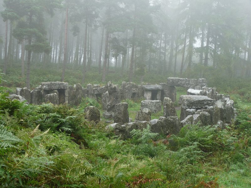
Then we were into woods, and along another path, and found ourselves…… in a clearing, with an oval of standing stones, some of them fashioned into doorways or caves, but all of them contributing to a sort of over-furnished Stonehenge. It’s not North Yorkshire’s answer to Stonehenge however, but William Danby’s folly. William Danby was the owner of the Swinton Estate, on whose lands we were standing. That is, both William Senior, who lived in the latter half of the 18th century, and William Junior, his son. Which of them built the folly is a bit of a mystery. Both of them were probably intrigued by the Druids. Poets and antiquarians at the time saw them as England’s earliest men of learning, the guardians of early belief-systems, and the first English patriots. Some say too that this ‘ancient temple’ was devised as a means of providing employment for men returning from soldiering in the Napoleonic Wars. There’s a story that there was a seven-year job on offer to anyone who would live as a hermit on the site. It’s thought that nobody stayed the course.
Druids Temple
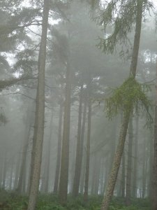
We explored the stones and caves, standing atmospherically on this slightly misty day at the edge of a suitably gloomy forest.
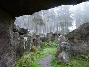
Another view from the temple.
And then we went for coffee and cake at the Bivouac, a marvellously isolated and quirky cafe on a site -with-yurts for serious glampers. Definitely worth a detour. Suitably fortified, we finished our circular walk, and were back at home in time for a late lunch. A healthy walk, a couple of history lessons, a great coffee-stop. What better way to start the weekend?
Here be druids.
I should mention that these photos give quite the wrong impression of our not-at-all miserable day. They were actually taken earlier this week, when the weather was really gloomy, and our French friends were still here.
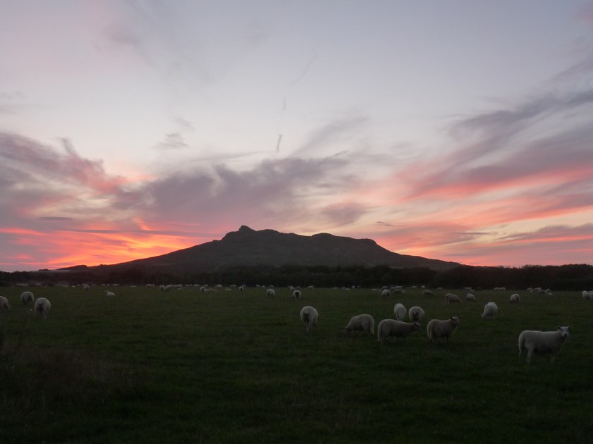
We’ve just come back from a glorious long weekend in Pembrokeshire in South Wales, with son, daughter-in-law and her parents. We were near St. David’s, Britain’s smallest city. Its population is the same as that of Laroque d’Olmes, and in other ways too the area seems to qualify as Ariège-on-Sea. Craggy mountains; fields of sheep and cattle; tiny one-track roads where the only likely traffic is a tractor, or even more likely, a herd of cattle coming home for milking; and long vistas, from the hill tops, of apparently endless countryside. And of course, the sea.
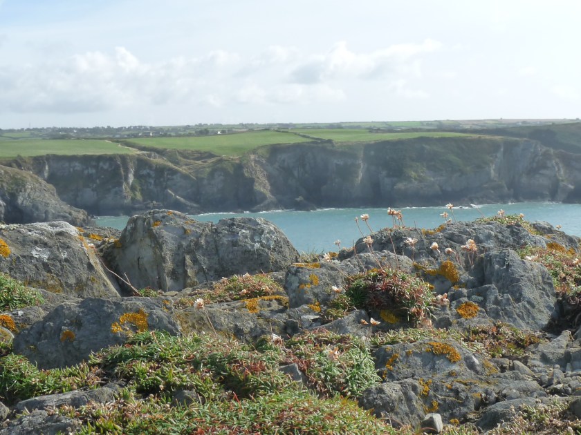
Our objective was to cover a goodish distance along the Pembrokeshire Coast Path. It’s some 299 km long: we managed about 40 km. so we have some distance to go. But what a journey. This scenery must be among the most stunning in the UK. Steep limestone cliffs and bays, volcanic headlands, beaches, inlets and flooded glacial valleys are the home to innumerable seabirds, and at this time of year, seals seeking sheltered nurseries to give birth to and rear their pups.
This slideshow requires JavaScript.
For me, this was the toughest walking since we’d left the Pyrenees. You know where you are there. On the whole, you’re walking up a mountain. Then you come down. Whereas along the coastal path, you’ll be scrambling upwards to reach the top of a high cliff, before descending again, perhaps almost to beach level. Then up again. After that you might swoop down to a cove before marching upwards to the next headland… and so on. Bright sunshine, warm breezes, and bracing sea air cheered us along and kept our energy levels high…. until the evening, when we found ourselves drooping and heading for bed as early as 10 o’clock.
Wednesday, August 20th. The morning air was chilly, just a little damp and drippy. Flowers in the borders hung their heads, their petals shabby and tired. Autumn has arrived. It does seem a little previous.
‘All is safely gathered in/ Ere the winter storms begin’
All the more reason to get out and about, before the days really close in. Ripon Ramblers chose to go to Harewood.
You’ll perhaps have seen Harewood House on TV recently, as that’s where the Tour de France really started from this year, after the Départ fictif from Leeds.* Half way between Leeds and Harrogate, it’s a playground for both towns, with its fine Adam-designed stately home, and extensive grounds designed by Capability Brown. At the time, the 1750s, investment in the slave trade brought immense wealth to the Lascelles family. Their descendents, the Earl and Countess of Harewood live in these fine surroundings built two and a half centuries ago. This stately home is regarded as being among the finest in Britain and is for the most part open to the public.
Our walk took us on a circular path that began outside the grounds, over farmland and with views across the Wharfe Valley. The route across the cow pastures was a bit of a puzzle. Weren’t those mango stones beneath our feet? And melon seeds? And even squashed tomatoes? The smell of rotting fruit wasn’t what we looked for on a country walk. Finally a young woman from a nearby stables helped us out. A local supermarket regularly dumps its surplus fruit at this farm for the cattle to enjoy. Four tons of fruit seemed to us to be remarkably poor stock control on the shop’s part, and we couldn’t help wondering what the cows’ insides made of this exotic diet.
Cow on a mango-hunt.
Far more enjoyable were the autumn fruits that lined our route for much of the day. We gathered blackberries every time we felt hungry or thirsty. We enjoyed the sight of haws turning red, elderberries turning black, and prickly chestnuts swelling and fattening on the trees.
Blackberries waiting to be picked.
Hawthorn berries ripen.
Elderberries too.
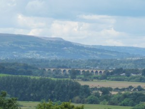
We completed our upward yomp, and walked along the ridge which offered a fine panorama across to the Crimple Valley and Harrogate beyond, to Almscliffe Crag, and even Ilkley Moor. Clouds in a dramatically cloudy sky were unloosing light rain into the nearby plain, and the breeze soon pushed the showers our way…..
Look carefully. You’ll see rain falling in the plain below. But not on us.
….and then pushed them on again, so that we could enjoy a rain-free lunchtime picnic with all that view before us.
Lunchtime view over the Crimple Valley.
After lunch, we were in the grounds of Harewood. Not the formal grounds near the house itself, but areas of woodland, pasture, lakes, deer park and farmland. And in the distance we spotted a fake Dales village, only built in 1998. This is Emmerdale, used in filming the long-running soap of the same name. No filming that day, so we were soon on our way, hurrying now before the rain, promised for mid-afternoon, settled in to spoil our walk. We made it – just.
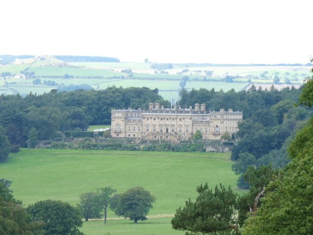
Our best view of Harewood House came at the end of our walk.
* The ‘départ réel’ of the Tour de France from Harewood signified the true beginning of the race. City centre Leeds was no place for cyclists to jockey for position, so riders just tootled out to Harewood on the ‘départ fictif’. Then the action started.
I’m not fully adapted to country life yet. Forward planning – or lack of it – is my failing. I haven’t yet learned to anticipate whether we’ll need more milk, potatoes or whatever before the next planned trip to The Great Metropolis (aka Ripon), and quite often find myself grubbing around at the back of the cupboard for acceptable substitutes.
Saturday, though, is the day we treat ourselves and buy the paper. There’s enough reading material there to get us through several days, and the sports section, discarded immediately, is perfect for any number of little jobs such as lining the rubbish bin. And yet today we had no excuse to visit Ripon, so would we have to go without our newspaper?
Well, no, there is another solution, but we have to reckon on leaving the house for well over an hour to complete the three and a half mile walk. The round trip to the paper shop involves leaving home along the path through the woods, walking along the riverside path to Sleningford Mill caravan site, dallying by the weir for a few minutes, battling along the narrow path now surrounded by chest-high spring flowers, and finally reaching the bridge at West Tanfield.
The shop in the village is where you’ll find most things. There’s food, drink, first aid and stationery – and a Post Office. There’s a community board where today I found news of someone selling chilli plants – I’ll be buying some of those . And there are newspapers. I bought our weekly fix. Then I set off home by a different route. Out of the village on the road, up the hill, turn right at a farm gate. The path here’s been slightly diverted, because the farmer’s made wide beetle banks to boost the number of farmer-friendly insects and spiders on his land. Through several fields of sheep, who come to inspect me, and along the drive of Sleningford Park, a country house. A final yomp along paths running alongside fields of wheat and barley, and I’m home once more.
It wasn’t quick. But I came home refreshed by the birdsong I’d heard; the sight of birds, rabbits, squirrels and sheep I’d passed; the flowers I’d spotted on the paths, different already from the ones I’d spotted only a few days ago; and all those country smells, from wild garlic to sheep dung to spring flowers. I’d had a better morning, I reckoned, than if I’d either gone without, or jumped in the car to grab a newspaper at the petrol station four miles away.
This one’s for our French friends: a stone and gated style, walkers-for-the-use-of.
Another valley, another view.
Spotted in a village garden, and obviously nicked from outside some French hamlet. Not Rimont, then, but where?
Another view across the Dales
Swaledale sheep: the image of the Yorkshire Dales.
A rather fine dry stone wall.
Our lunch time view.
Our lunch time companions.
Setting forth after lunch.
The River Ure at Aysgarth.
The falls at Aysgarth.
A final view of the river.
A few late primroses, still bright and fresh.
About time too. Five weeks in England, and still we hadn’t got out and done a Proper Walk. With a Proper Group. Blame the general business of unpacking, organising furniture, pots and pans, clothes, books, pictures and day-to-day Stuff in our new home. Blame constant strings of communication with officials who Need-To-Know our new details. Add in those who fail to respond, perhaps because they no longer have local offices and, understaffed, are too overwhelmed with work (DVLA ?), and you have all, well, some of the excuses you need for our having failed to get a decent walk in.
There was a certain reluctance too. So many of our happiest times in France were spent discovering the region with our Sunday and Thursday walking friends. Apart from the scenery, we remember with so much nostalgia the conviviality and the leisurely picnics, as we all produced cheeses, charcuterie, bottles of wine and home-made cakes to share at the lengthy midday pause.
All the same, we shouldn’t have worried. Yesterday we met members from a local group, unsurprisingly the one from Ripon. We got ourselves to Wensleydale, to a picturesque village called West Burton, and had a hearty, but not too hearty, walk across to Aysgarth, before winding our way back. We loved it. The group was welcoming and friendly. The walk had just the right amount of challenge – we have become just a bit unfit – and the views were all we hoped for. The weather was good too. Breezy, but not cold, and plenty of sunshine.
There was only one small disappointment. At lunch time, British walkers sit with their own personal sandwich, get it eaten, then move on again. But even that disappointment was relieved when at the end, Our Leader spotted a tea shop. Sitting round over a large pot of tea, cakes for some, as we reviewed the day was a pretty good end to a pretty good walk.
…. which is, being very roughly translated, our pot-luck picnic on the Resistance trail.
Posh picnic? I think not. But it’s the taste and the company – that counts.
Jean-Charles has long wanted to get us up to Croquié, a village high above the road between Foix and Tarascon, for a walk with a 360 degree panorama of the Pyrenees, and a very moving monument to some of the Maquisards who died fighting in the French resistance in World War II. This really was the last Sunday we could go, and the day was glorious: hot, with clear blue skies and views for miles and miles in every direction.
Neither Malcolm nor I is particularly on form at the moment, so while our Laroquais friends yomped up a semi-vertical path, deeply slicked in mud, we went part-way up the mountainside from the village of Croquié by car, and then walked on up by road (a road, however, closed to cars) to meet the rest of the group.
Our first destination was the Monument to the Resistance. This site, with views across to the mountains dividing us from Spain, far-reaching from west to east, was chosen as a memorial site not because it was a war-time battle ground. Instead it was a training school for resistance fighters from France, Spain and beyond. There are no barracks, no lecture-halls, no buildings of any kind. Instead the men led hidden existences among the forest trees and rocks. And now there is a fine memorial to them. Singled out were two men who died in nearby Vira (the area where we walked last week) a Maquis stronghold, one who died in our neighbouring town of Bélesta, and one who died following deportation. There is a statue to these men, who are nevertheless depicted without facial features. In this way they stand representative for all the men – and women – who died whether through fighting, by acting as liaison workers, or by offering essential support by giving shelter, clothing and food. Individuals did not pass over to Spain from here: the border is too far away. Instead they were driven to one of the freedom trails such as those near Oust and Seix. Petrol? It could be organised, albeit with difficulty. A key man ran a garage.
First glimpse of the monument.
A better look at it
This is the view those figures have
The sculptor of this monument is Ted Carrasco. A native of Bolivia, pre-Columbian art is a clear influence on his work. He seeks always for his pieces to be in harmony with the environment in which they are placed. His monumental granite figures look over to the Pyrenees which were the scene of their fight against fascism and the Nazi occupation of France.
Time to move on, however. Our path took us slowly upwards through forest, along a track which became increasingly snow-covered and tough going. However, it was only 3 km. or so until we reached the top, where there’s a refuge dedicated to the memory of its original owner, Henri Tartie, known as ‘l ‘Aynat’ – the elder, in Occitan. The original structure is tiny, but served as shelter to many a Maquisard . Now it’s a wood store, because a newer concrete annexe has been added with cooking facilities so that hardy mountain walkers can rest, make a meal, and warm themselves up.
The way up to the refuge.
Jean-Charles gives us a short history lesson outside the refuge.
The modern extension and its ‘facilities’.
A cheerful picnic.
This was our view.
And this.
And this.
This too.
And this , on the way down.
We commandeered a circular concrete table outside, with apparently unending views of those Pyrenees, and somehow squeezed all ten of us round. We unpacked our food: as ever there was wine to share, rhum baba à l’orange, galette charentaise, biscuits – all home-made, of course. Malcolm and I knew it was our last walk with our friends. The fine views, the fine company, the cheerful conversation had a predictable effect. We became tearful. But so grateful that this walk was a bit of a first. Extra-special views, extra-special weather for March, the chance to get close to an important slice of Ariègeois history, and our extra-special friends. We shan’t be with them next Sunday: there’ll be too much to do. It doesn’t bear thinking about.














You must be logged in to post a comment.