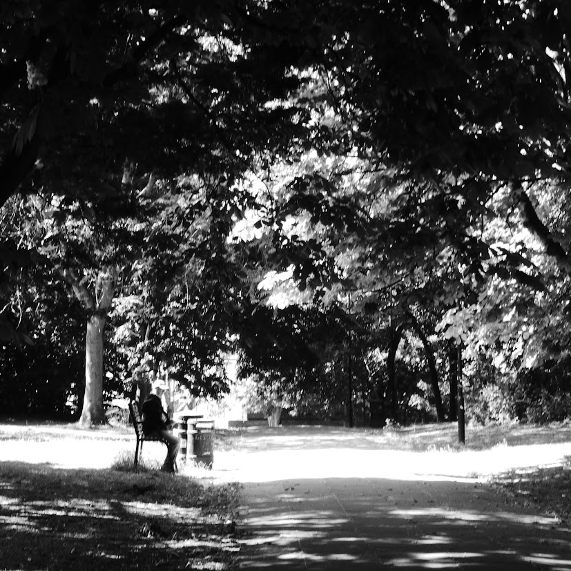
We’re off to London today, to catch some shadows in its grittier streets, to satisfy both Becky’s NovemberShadows, and Leanne’s Monochrome Madness. But first, we could relax for a few moments in a park near Canary Wharf, as shown in the header photograph.
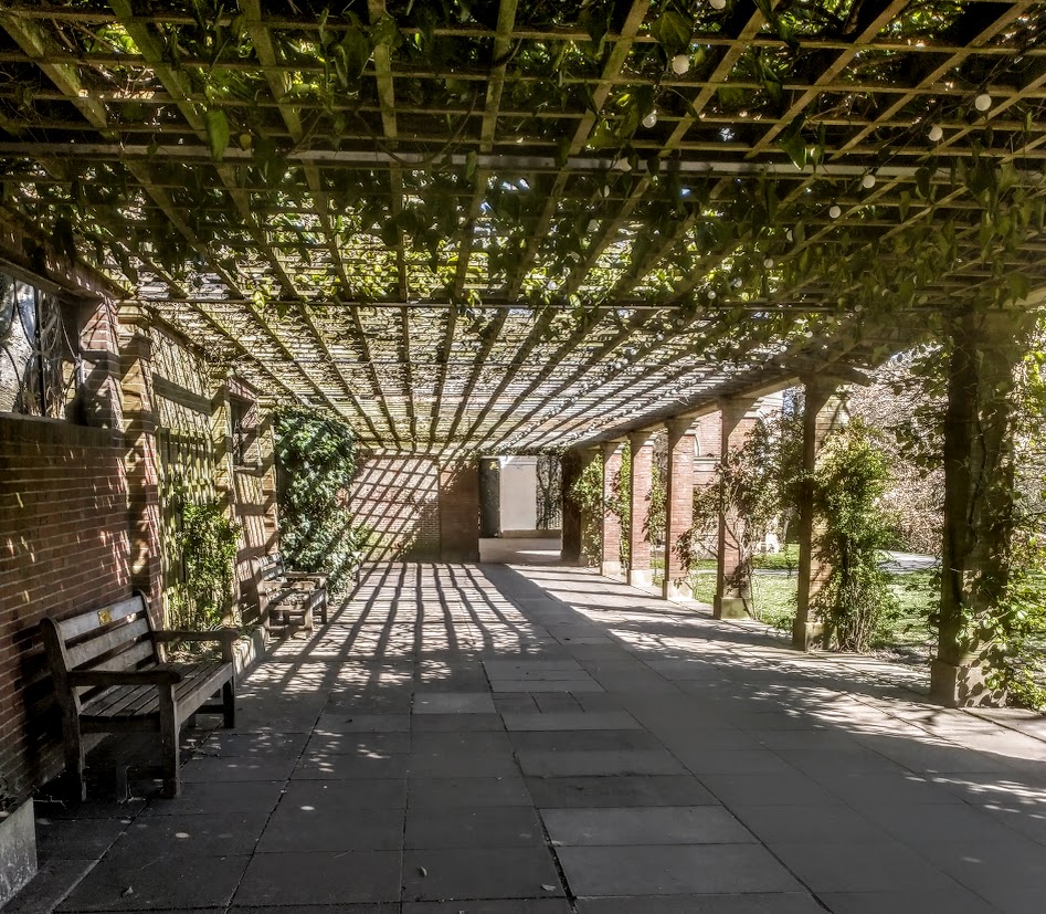
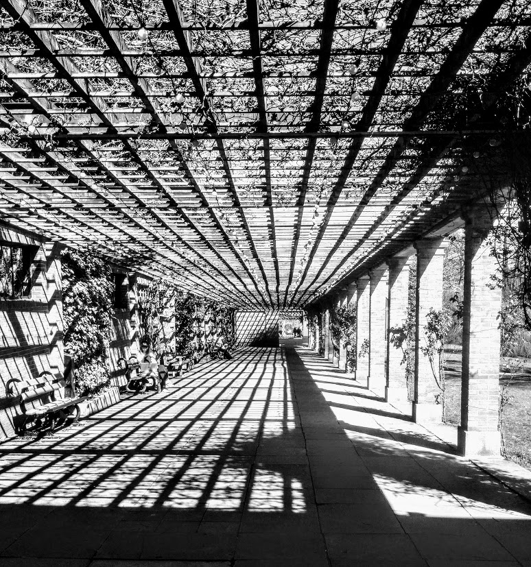
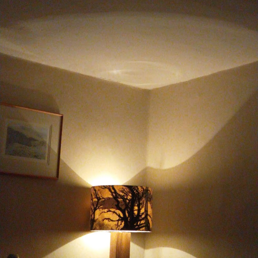
This relaxing spot in the Valley Gardens in Harrogate is one I’ve shared before. But the shadows are so very distinctive, they deserve another outing for NovemberShadows, I think.
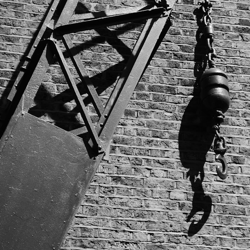
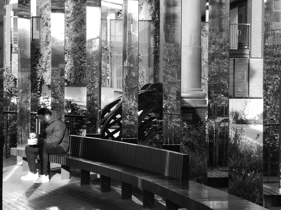
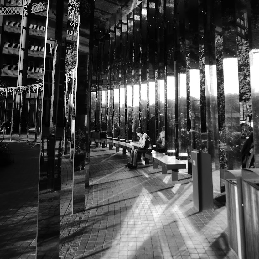
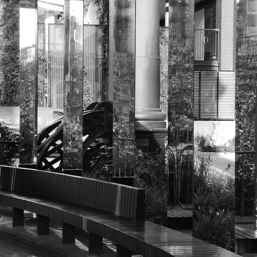
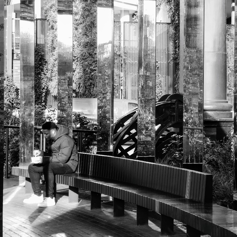
A mooch round a sheltered area of London’s Gasholder development revealed plenty to deceive and intrigue the eye for Becky’s NovemberShadows, and Jude’s Bench Challenge.
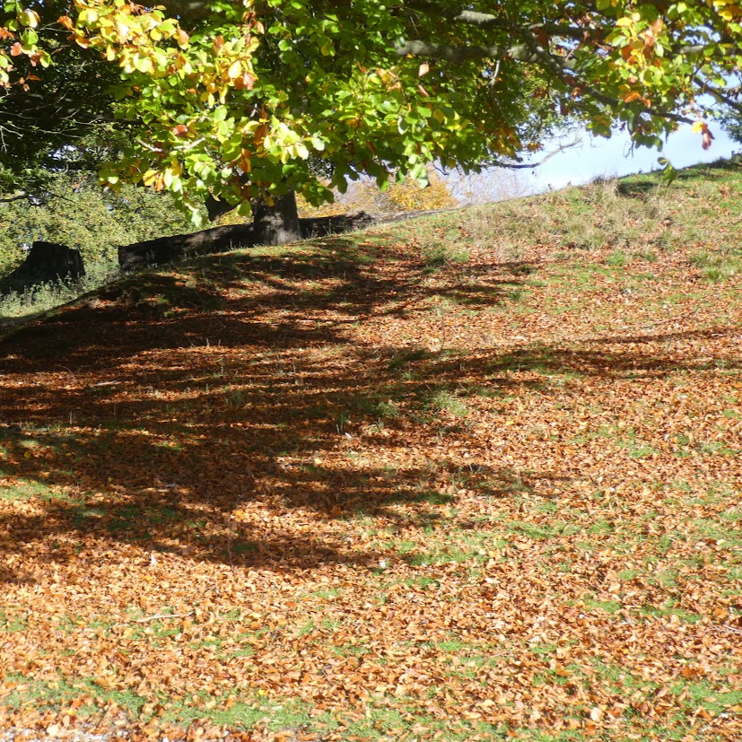
Shadows fall below this venerable sweet chestnut tree.
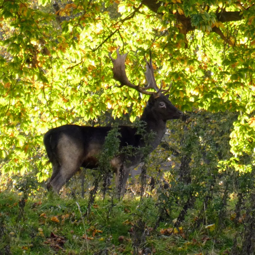
To begin a month of Shadows for Becky’s Month of Squares, I bring you a photo from Studley Royal, where the rutting stags vie for attention with the autumn colours.
Probably too young to join in the rut, this stag poses against dappled shadow.
Thank Becky, for being Queen of Squares once more.
On our recent trip, mainly to Alsace, but with sorties to Germany and the Netherlands, we came across several stories from the past which we’d known nothing about, but found engrossing. For the next few Fridays, I’ll share these stories with you.
Ammerschwihr
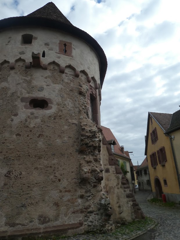
We happened upon Ammerschwihr on our way back from Le Linge and decided to stop, attracted by its mediaeval town gates.
The first set of town gates we spotted
It’s a prosperous little town. This commune is home to the highest number of winegrowers in relation to the number of inhabitants anywhere in Alsace. And that’s saying something.
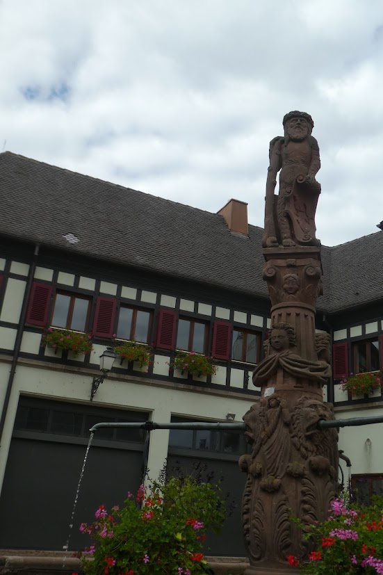
In front of modern housing in traditional style is this fountain of the Wild Man of Ammerschwihr, 1560. He’s holding a shield showing the town’s weapons in one hand, while leaning on a vine stock.
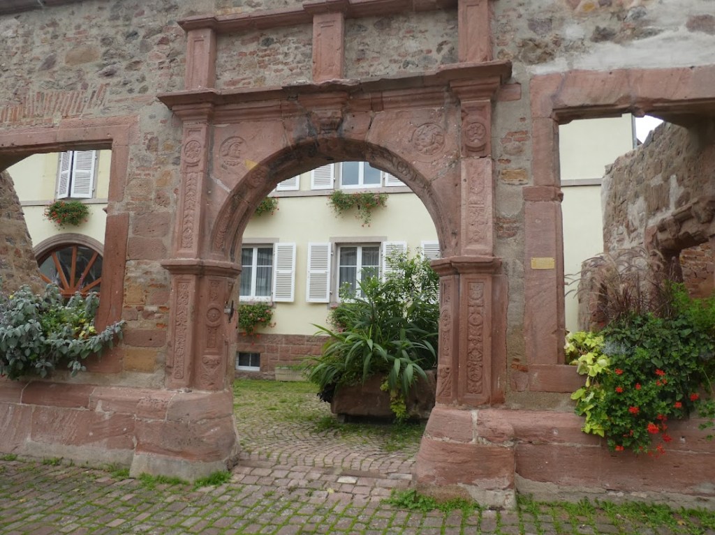
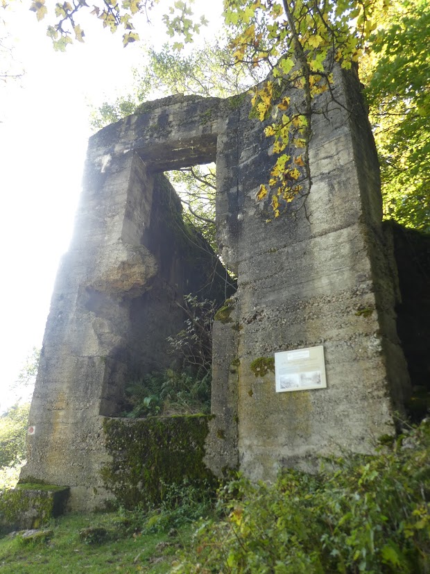
As we mooched round, it gave the air of being yet another pretty town of half-timbered houses. Until we reached the old town hall, which these days doesn’t even justify being called a facade.
What’s left of Ammerschwihr’s former Town Hall
Then a small plaque. Oh! So it was destroyed during the war?
The Town Hall, built in Renaissance style in 1552 was destroyed in an act of war in December 1944. It’s classed as a historic monument.
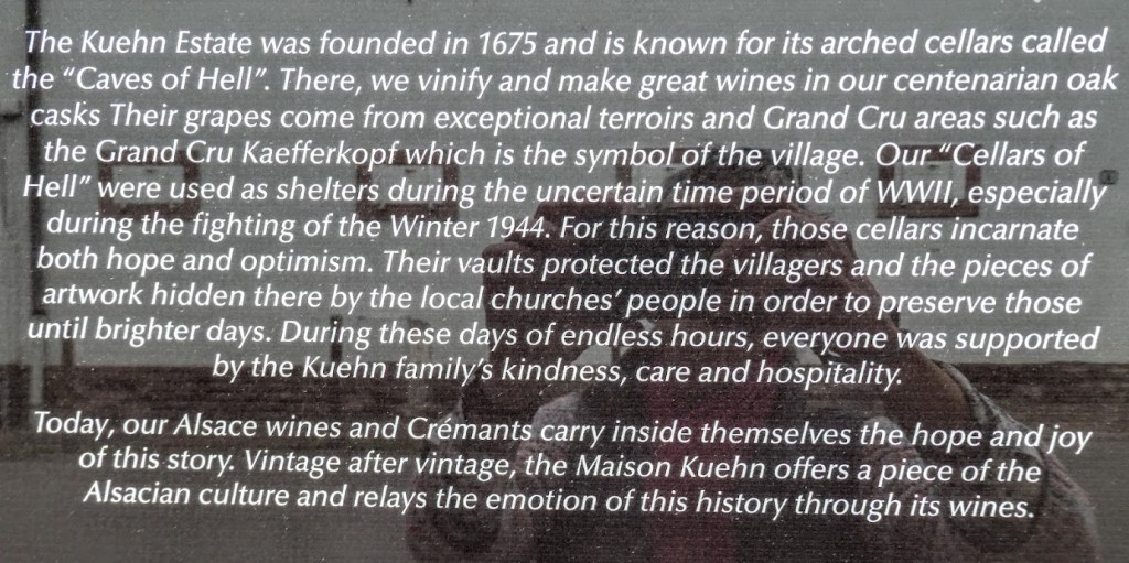
Buildings nearby were clearly more modern, though sympathetically built to fit in with the ancient centre (which we later realised were also reconstructions). We found another notice, attached to the wall of one of the many wine producers in town.
We needed to know more.
During the later stages of WWII, The Battle of the Bulge was the Germans’ last attempt to break through Allied lines. They gained a dangerous amount of French territory in a campaign which though apparently well known, I hadn’t heard of. The Allies promptly regained much of this territory, except in an area near Colmar, which became known as The Colmar Pocket. Ammerschwihr was in this zone, and like so many other nearby communities, it lost 85% of its buildings to bombing raids in December 1944.
But the ins and outs of military campaigns are above my paygrade, and if they interest you, you can read about them here and here. I prefer to know what life was like for the women and men on the street. Although I read that the conditions for the serving soldiers during this part of the war were truly horrendous. A particularly harsh winter in 1944 – 45 meant that both sides endured the sheer misery of fighting in deep snow and mud in totally inadequate clothing. Getting supplies to them was a sometimes unachievable struggle. Casualties were extremely high.
For the civilians, life was no better. Ammerschwihr wasn’t evacuated, but many villages were, and unending columns of the dispossessed trailed to what they hoped was safety, having lost everything but the little they could carry. Those who remained faced street barrages, hand-to-hand fighting. Food and often water were hard to come by, and the population hid in cellars, sharing what little they had. For those of us whose territory wasn’t invaded during WWII, this suffering is almost unimaginable. And afterwards – the long hard road to reconstruction, and trying to re-establish some kind of normal life.
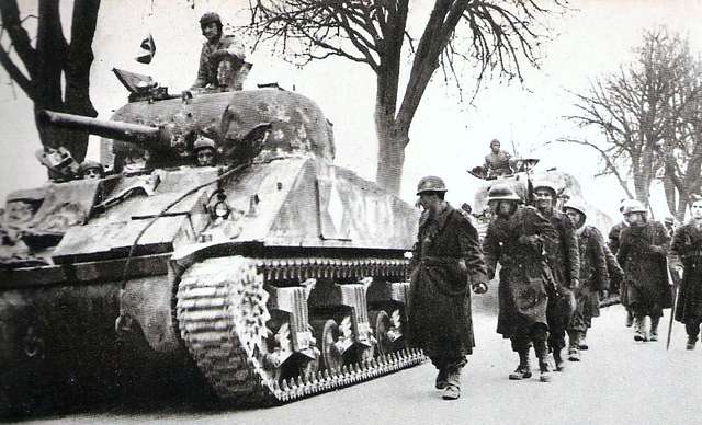
The victorious French advancing through Colmar in 1945 (Picryl.com)
Here’s what it says in WWII History Tour: Colmar Pocket
Once under German control, Alsace was subject to forced Germanization policies. The use of the French language was banned in schools, public spaces, and even private conversations in many cases. Street names were changed, French cultural symbols were removed, and local populations were pressured to embrace a German identity, often against their will. Families with French allegiances were treated as enemies, and suspicion ran high among neighbours, with the region caught between two nations. The sense of belonging for Alsatians became deeply conflicted as they struggled to retain their unique Franco-German culture under oppressive occupation.
Perhaps the most devastating aspect of Nazi control was the forced conscription of Alsatian men, known as the “Malgré-nous” (meaning “against our will”). Thousands of young men were drafted into the German army, the Wehrmacht, and even the feared SS, despite many feeling a strong allegiance to France. Some were sent to fight on the Eastern Front, where casualties were extremely high. Families were torn apart, and many Alsatians who tried to resist conscription faced imprisonment, deportation, or execution. After the war, the return of Alsace to France did not immediately heal the scars. The region carried the burden of divided loyalties, lingering mistrust, and the painful memories of occupation and forced service, which shaped its identity for decades to come.
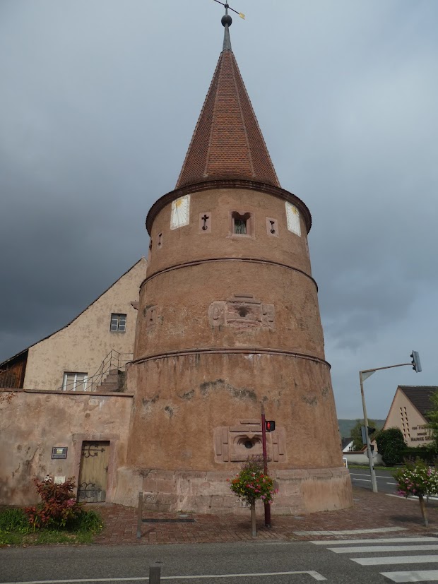
It was hard to reconcile all this with the charming, civilised, peaceful little town we wandered around. The nearest we got to the unpleasant realities was this building, once a town gate, once in fact a prison, and known as Le Tour des Fripons – the Tower of Knaves. It all seemed much less immediate than the town’s more recent disturbing history.
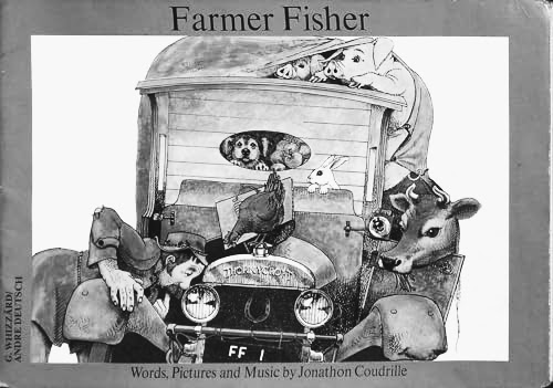
One of the first picture books to come into the house – oh gosh – more than 45 years ago, delighted all three of my children, and the adults who read it with them. It’s still sought after, this early edition, but you’ll have to shell out about £25 to get a copy. The book was Farmer Fisher.
Farmer Fisher had a fine fat truck.
You couldn't see the colour for the farmyard muck.
In the front was a rabbit and a chicken and a duck -
On the way to market.
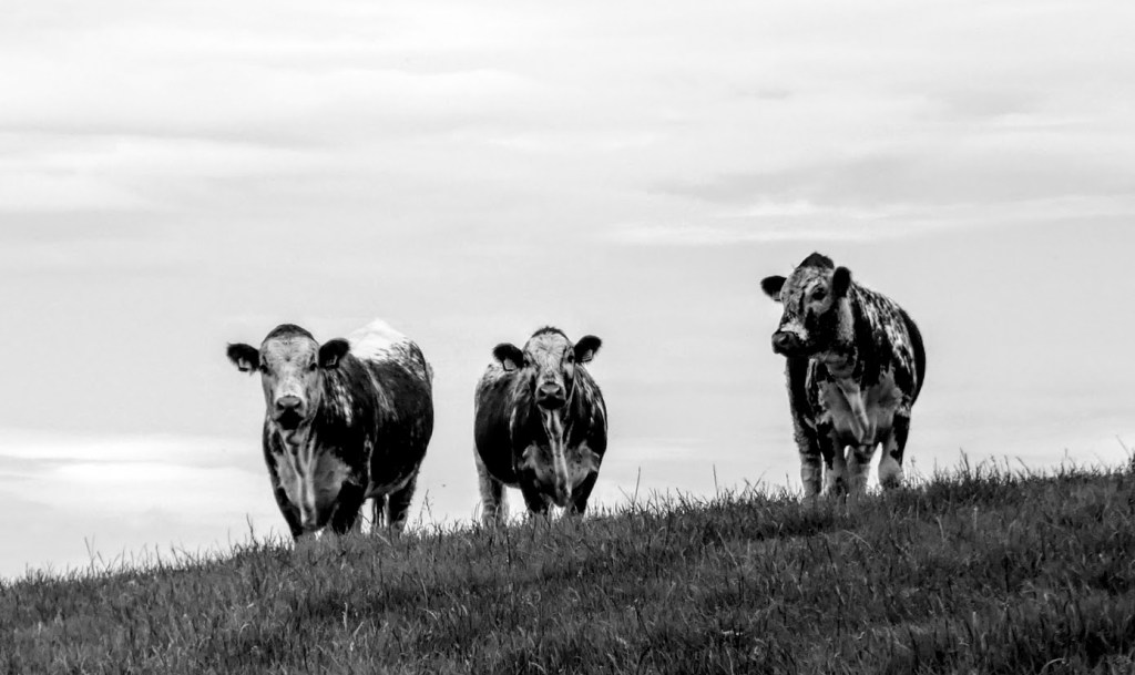
Well. I won’t be showing you a rabbit. I haven’t got a shot of one. Or a chicken. Or a duck. Elke, for this week’s Monochrome Madness would like us to show farmyard animals, so I’m sticking to four legged examples.
Like cows …
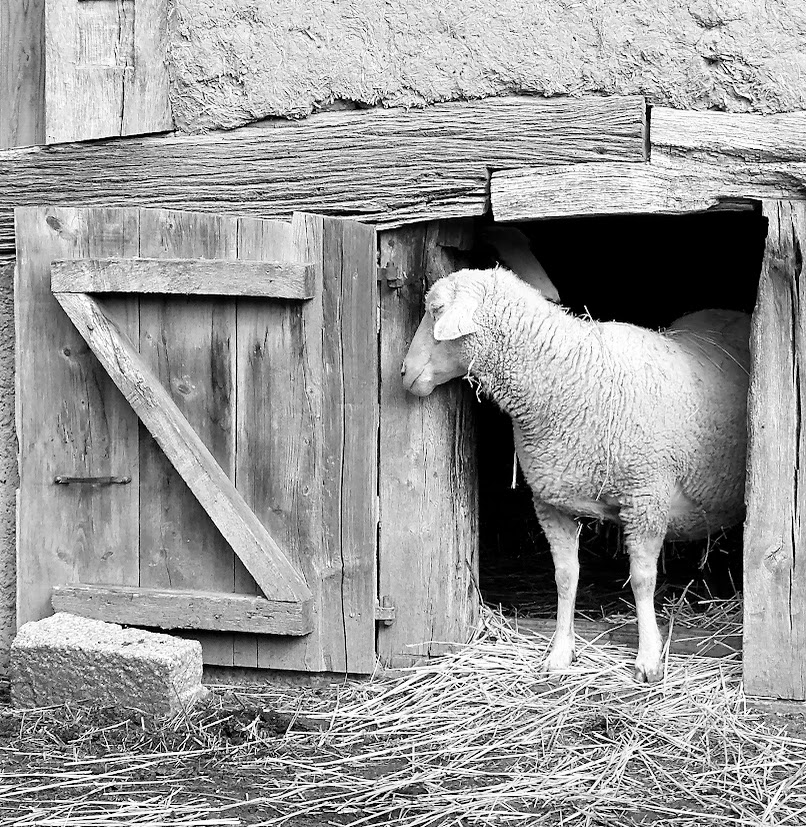
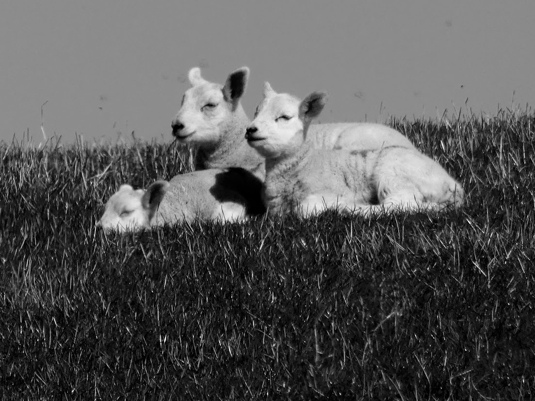
… and sheep …
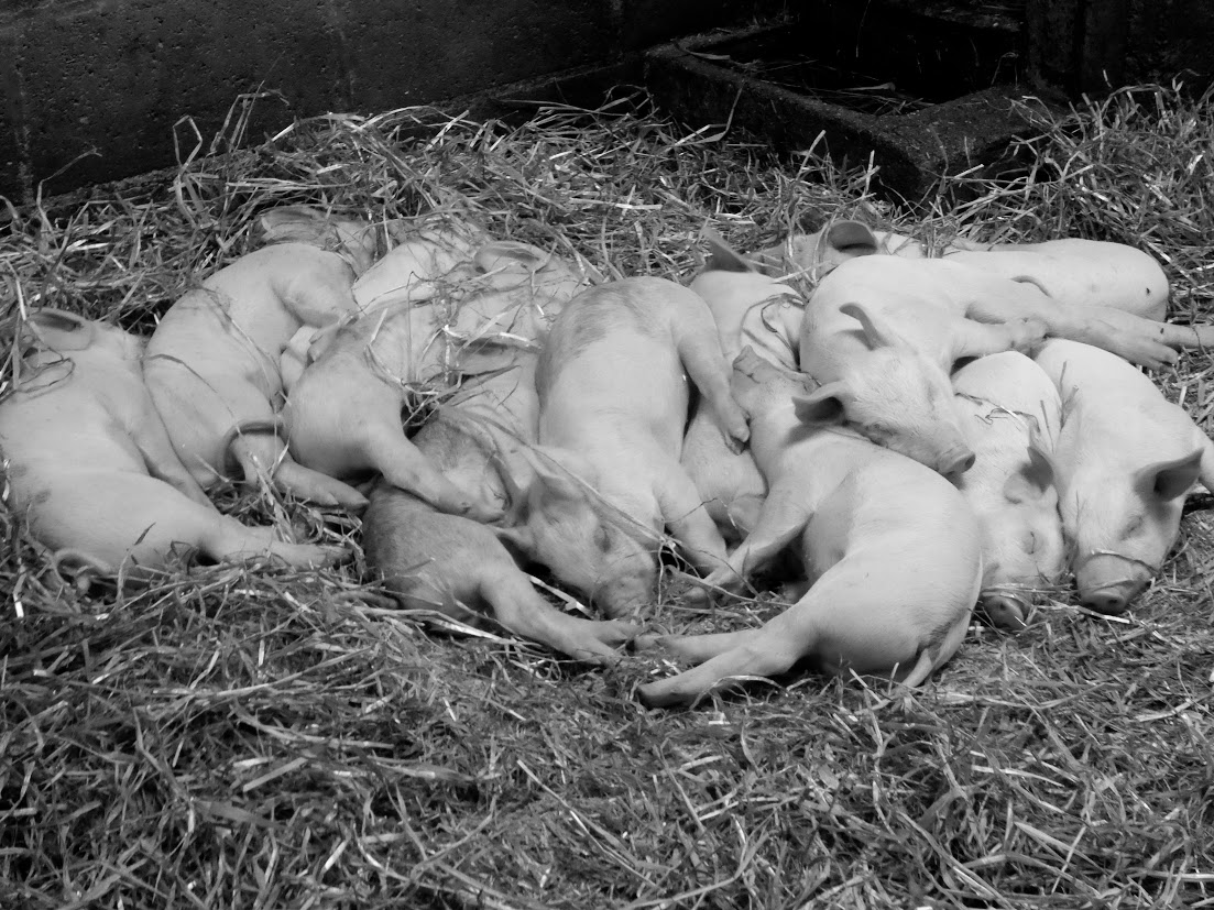
… and pigs …
… and a goat …
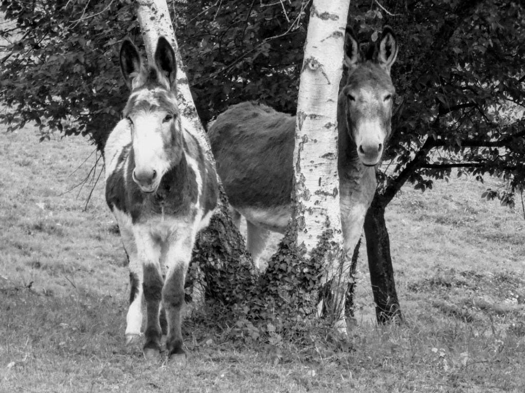
… and not forgetting donkeys. Not useful, but easy to love.
And here’s a little library of livestock to finish with.
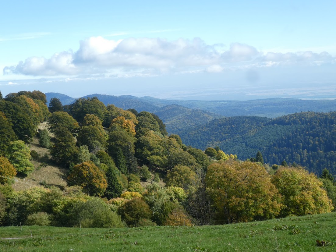
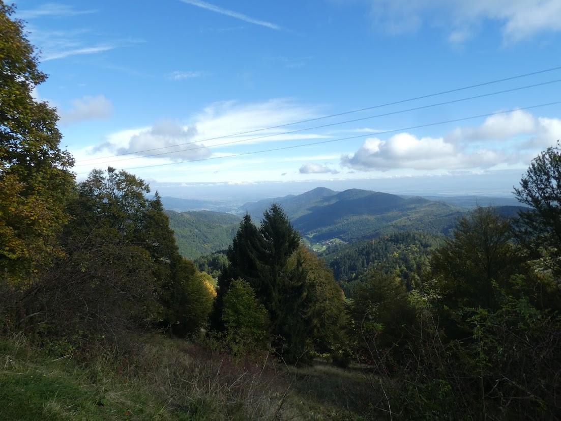
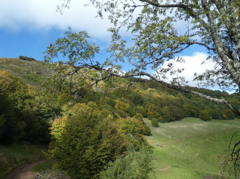
Since we left our home in France, eleven years ago, I’d forgotten the exhilaration of walking in the mountains. The Vosges are not the Pyreneees, far from it. But they offer the same reward of yomping, puffing and panting ever the harder, up the steepest of slopes before finally offering you views- across to distant slopes, and to valleys below: pastures, forests, settlements.
So in Alsace, Malcolm and I picked our chosen pastimes – walking for me, cycling for him. And on this day, we’d driven about 15 km. from ‘home’ to only a couple of hundred metres below the summit of Le Petit Ballon, so he could enjoy the exhilaration of zooming downhill, then along the valley bottom on a series of cycle ways to our holiday premises. I was to enjoy the different exhilaration of climbing to the top of the mountain before walking down and up and down and up the circular route I’d chosen to get me back to the car.
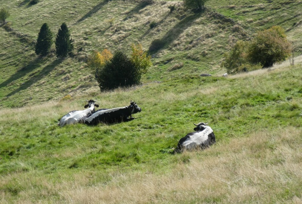
I passed cows first, the sound of their bells reverberating mellifluously far across the valleys.
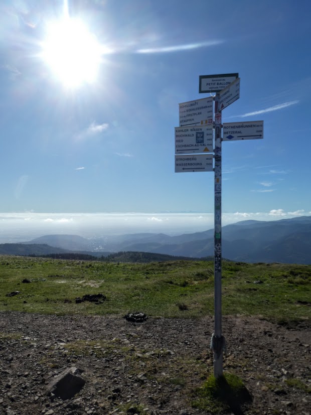
It was a hard slog to the top, but I got there, and was disappointed by the presence of a bulky and rather ugly phone mast. And then immediately went wrong. I was relying on a walk description in a booklet I’d bought, and on the French equivalent of our OS maps. Which we’d long ago discovered do not do anything like as good a job. I was to follow several different series of balises (waymarks), which are also inconsistent in their usefulness (they tend to be there when you don’t need them, absent when you do).
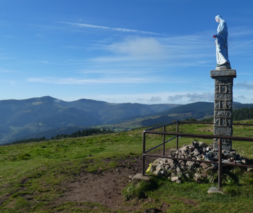
My booklet said to walk to the statue of the Madonna and turn right. I did. I walked downwards, and found a path which didn’t seem right. Coming across some walkers from a French rambling group, they greeted me cheerily. ‘Are you alone? Come with us!’ I was tempted, but they were going the other way. But they pored over my map with me and set me right before going on their way. Anyway, it turned out I had followed the Wrong Madonna. Who knew there would be two in more or less the same area? I adjusted my walk plan and carried on.
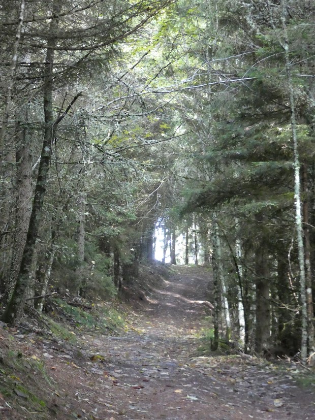
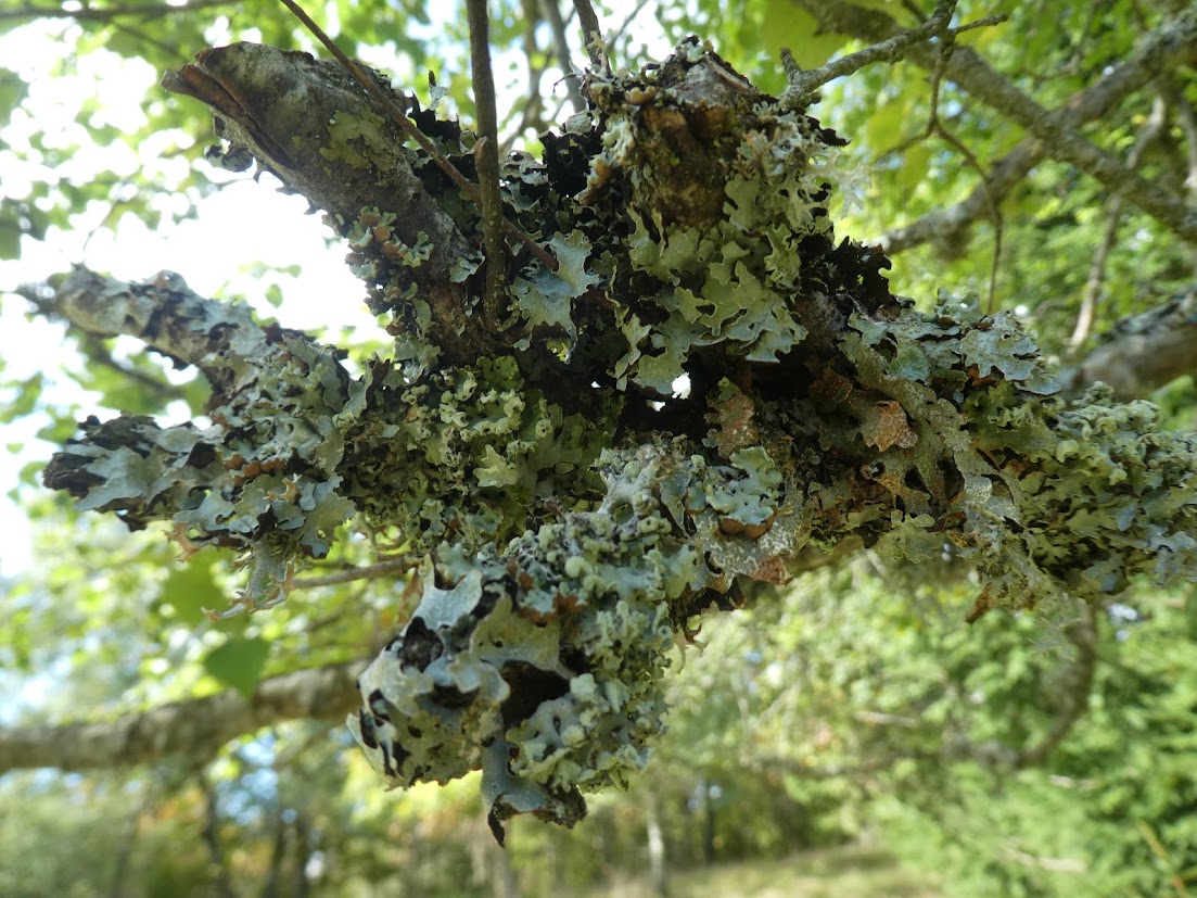
I passed through woodland, a rich loamy path, with weightless grey lichens clinging to every twig and branch. Then open pastureland with distant mountain and forest views.
Onwards and upwards, till I came to an open summit with boulders scattered randomly around, making a perfect choice of picnic venue for me, offering me views in every direction. It was just warm enough, just sunny enough. Perfect.
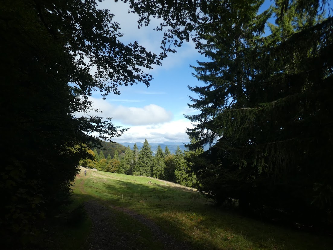
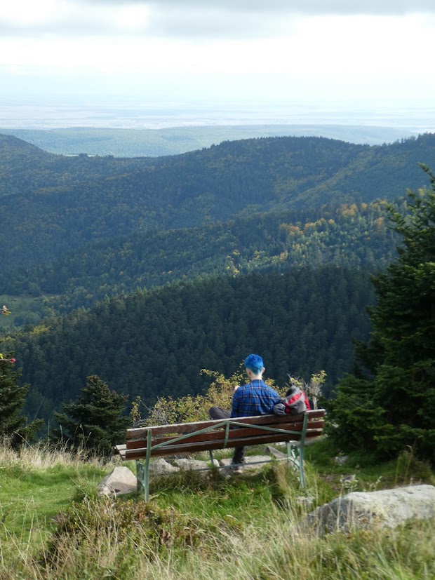
After lunch, the views became more open, the colours more autumnnal, the path, though inexorably upwards, was a gentler slope. I passed the peak with the bench I showed you yesterday, and meandered slowly down to the wooded valley. On my way down, I found a piece of history from 1915: the remains of a German téléphérique, used to transport goods and all the chattels of war: a reminder of all we’d learnt up at le Linge.
My final couple of kilometres were disappointing, along a road – the one we’d travelled ourselves en route that morning. But I’ve forgotten that now, and kept instead the memories of a fresh, bright day in early autumn: an energetic and satisfying walk.
This is by way of being a preview for Jo’s Monday Walk tomorrow. It’s a viewpoint near le Petit Ballon in Alsace, but as you see, the Boy with Blue Hair Bagged the Bench first. I still offer it for Jude’s Bench Challenge.
On our recent trip, mainly to Alsace, but with sorties to Germany and the Netherlands, we came across several stories from the past which we’d known nothing about, but found engrossing. For the next few Fridays, I’ll share these stories with you.
The Battle of Le Linge
Anglophone readers will all know the dreadful story of the so-called Great War, 1914 – 1918. Particularly the war in Flanders, with its trench warfare in which first the Allies, then the Germans, gained a few yards of ground, then lost it, and gained it again in manoeuvres that resulted in the pointless deaths of thousands upon thousands of men whilst upending the communities in which those battles took place, as well as the families whom they had left behind. It turns out that this story was repeated in very different territory too.
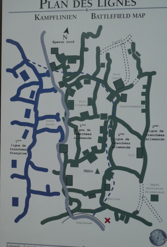
In the Vosges mountains, in territory which has through the centuries passed repeatedly between German and French hands there is a col known as Le Linge. It’s a mere 17 miles (28 km) from Colmar, but it’s a different, often desolate world, reached by travelling up apparently endless and steep hairpin bends which cut through dense forest and a rocky landscape untouched by human hands. On the day we went there, to visit the Mémorial du Linge, it was rainy: and I was glad. This was no site to enjoy in balmy sunshine.
Early on in the course of the war, both French and German commanders thought they could see advantages in taking control of Alsace, though both had sent the bulk of their troops elsewhere – notably the Marne.
Here’s what the Memorial’s own website has to say:
'Given the situation on the battlefield, the French army had to overcome enormous logistical difficulties . Starting from scratch, it had to build roads, camps, ambulances, aid stations, transport ammunition and supplies on mules, install heavy and light artillery, build battery emplacements, shelters and other necessary installations, andfinally transport the combatants, all in full view of the German enemy.
Faced with such preparations, the latter would not remain inactive and would prepare for the coming assault. Taking advantage of the shelter of the forest, excellent logistics (notably a narrow-gauge train from Trois Epis) and the proximity of the Alsace plain, the German troops established solid defenses. Trenches, shelters and connecting trenches were installed on the mountain, fortifications built, pillboxes and machine gun nests arranged, fields of barbed wire unrolled along the steep slopes between trees, rocks, brambles and other chevaux de frise (movable obstacles, often made of a wooden frame with spikes). These defenses added to the complexity of the battle for the French forces and further accentuated their initial disadvantage on the terrain.'
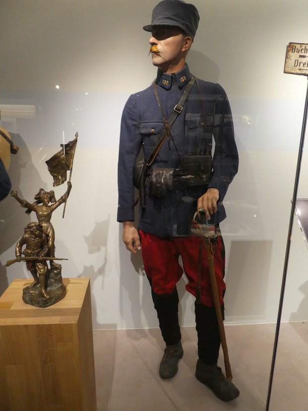
A German soldierA French soldier
Both soldiers here look almost 19th century, equipped for different battles from the long-drawn out trench warfare to which they were actually subjected.
From July 1915, battle commenced. There were attacks, counter-attacks, hand-to-hand fighting as each side was only feet away from their enemy. I read one account in the museum, which I’ve been unable to find again, telling of a batallion going into battle one night with over 2000 men, and returning in the morning with just 3 officers, and 28 men.
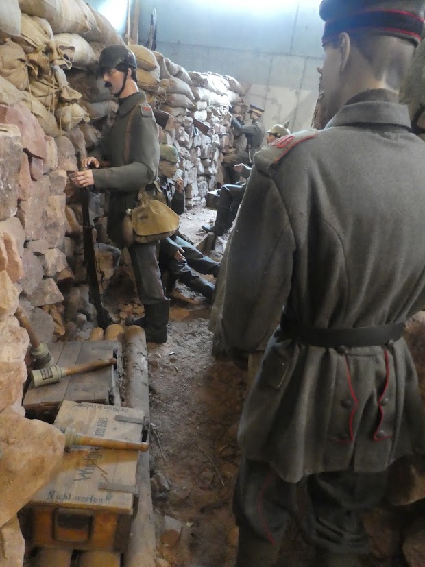
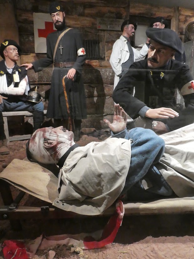
Life in the trenches as shown in the MuseumA French field hospital. Note the man smoking in the background.
Despite courageous resistance from the French, the German forces always maintained the upper hand. On October 16th, the last German assault took place, after which both sides retreated into an uneasy, exhausted, totally debilitated calm.
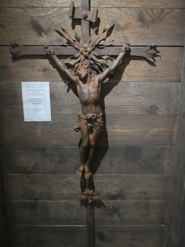
Pillaged from a local church, this was found displayed in a trench, doubtless as an impromptu altar.
And yet. Both sides retained a pointless presence there for the whole of the rest of the war, with skirmishes a daily routine. On average, 5 men died every day during the whole of this period: young men, mainly aged 19 or 20. Specialised forces were deployed, such as these troops here: skiers. Whole villages were forced to evacuate, and many remained abandoned after the end of the war.
Yet again, the website sums it up:
'The Battle of Linge, of no strategic importance, was a true human tragedy marked by the courage, determination, self-denial, and sacrifice of French and German soldiers.
It bears witness to the brutality and difficulty of the fighting of the First World War, where thousands of lives were wasted for often minimal territorial gains.'
A map of the trenches. No wonder I found it hard to get my bearings!
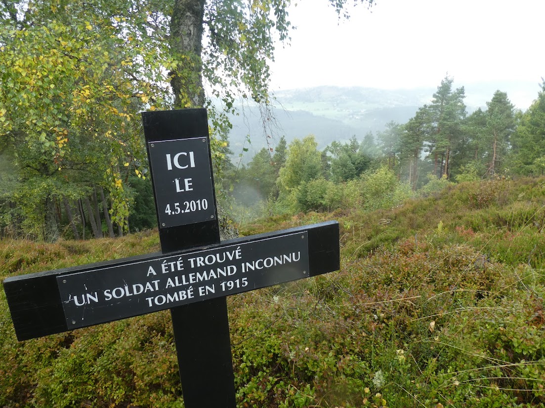
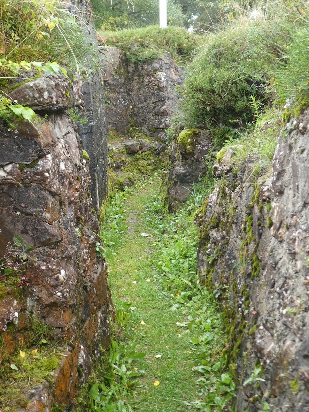
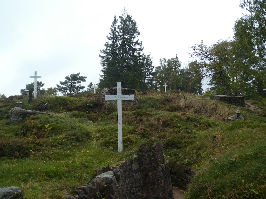
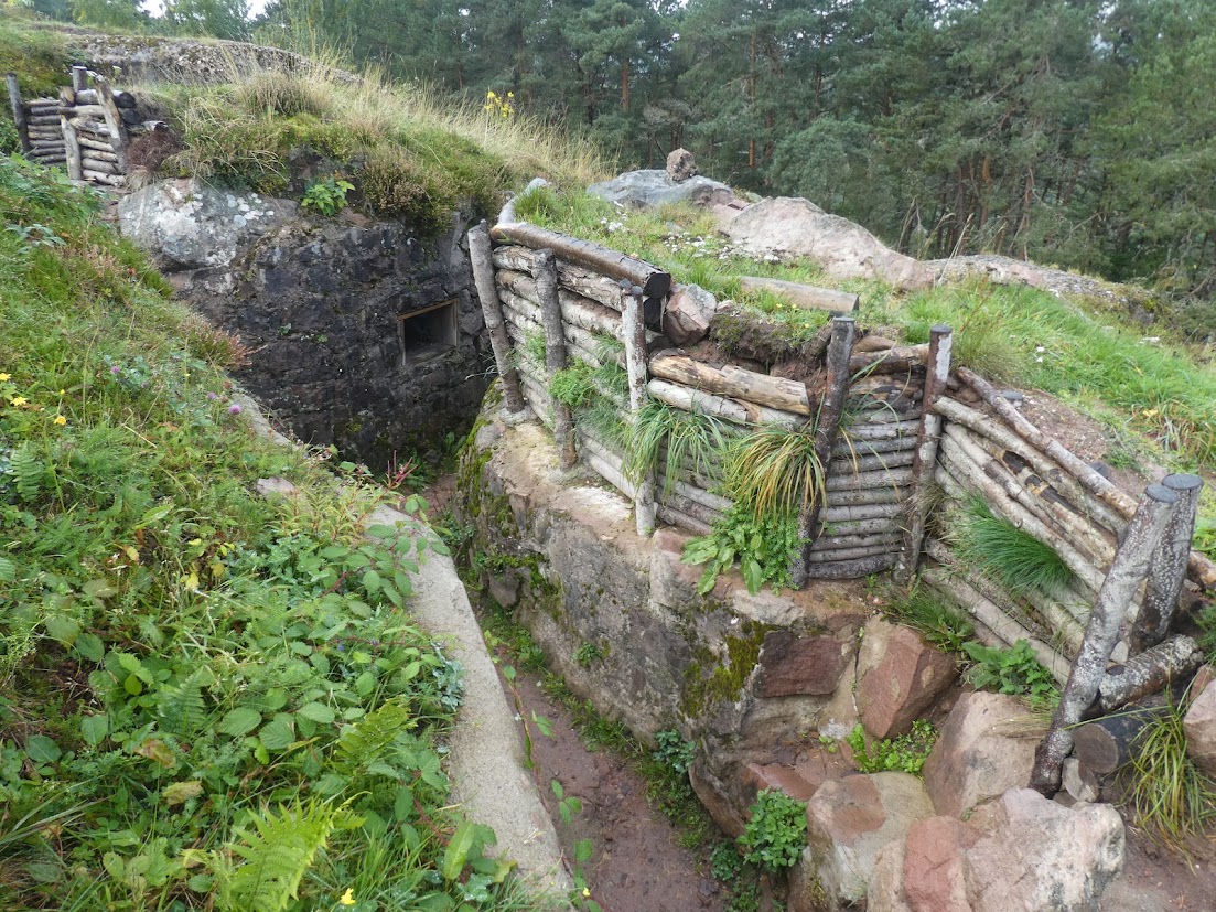
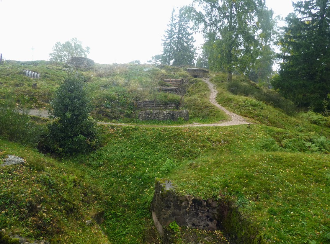
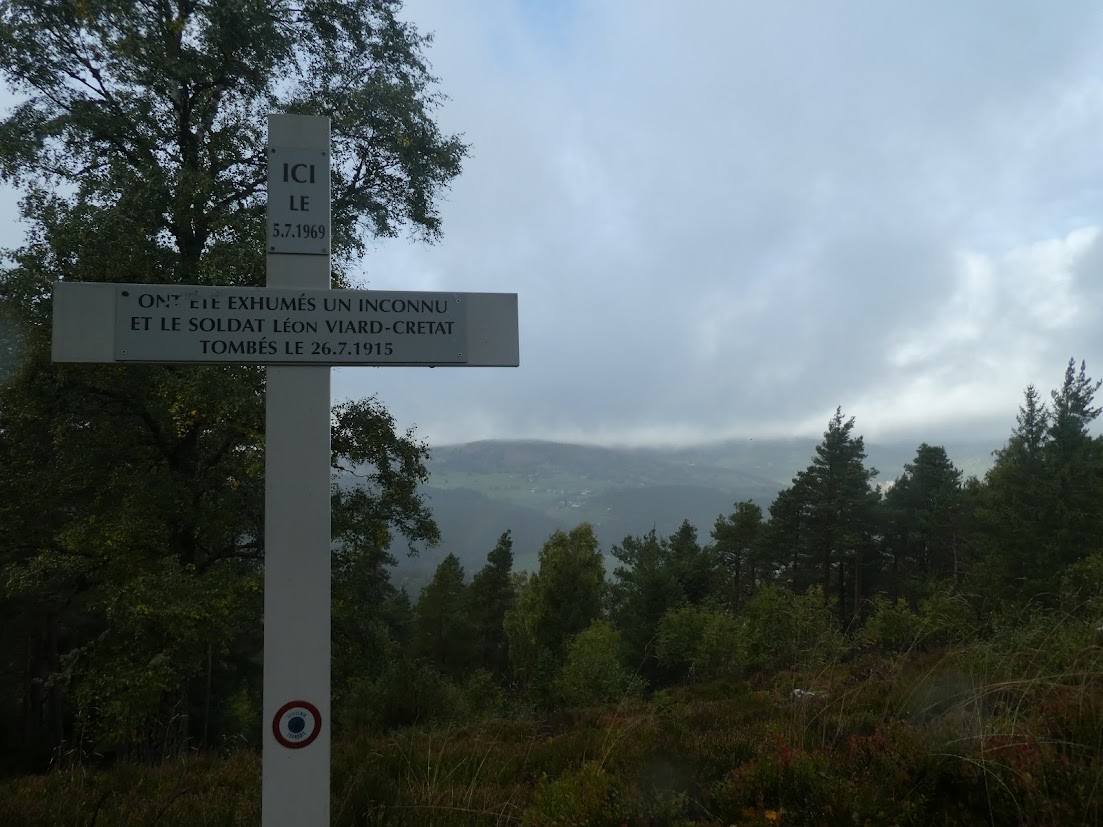
After the museum, it was time to go outside and inspect the trenches, still intact. We were reminded that those we see today would have then been about a metre deeper. As advised, I was wearing my walking boots – Malcolm wisely decided not to join me. I set off confidently on the ‘difficile‘ circuit, and after a degree of inelegant scrambling, retreated to the ‘moyenne‘, and finally to the ‘plus facile‘. The scenery was a treat: the terrain by turns rocky, slippy as gravel skittered away from me, slippery, steep, narrow, impassable. The trenches were cold, narrow, inhospitable, offering the occasional cave cut into the rock to offer shelter from rain, wind and- in winter – snow and ice. Winter temperatures there regularly fell well below freezing. On my walk I often passed a white cross, indicating a French corpse who had been found, or a black cross for a German. Both are now memorialised respectfully. It’s recommended that visitors take up to an hour and three quarters to discover the whole site. I did not. It was raining. I was neither a poilu*, nor a frontschwein**.
This was a thought-provoking day, and one which we shan’t forget, at a time when seeing images of war and its human consequences are still part of our daily routine.
*The French term for a infantryman, and actually meaning 'hairy man'.
** A frequent term for a German infantryman, meaning 'front pig'.


You must be logged in to post a comment.